Overview for Advent, CAMELFORD, PL32 9PY
Introduction
Camelford is a town and civil parish in north Cornwall, England, United Kingdom, situated in the River Camel valley northwest of Bodmin Moor. The town is approximately ten miles (16 km) north of Bodmin and is governed by Camelford Town Council. Lanteglos-by-Camelford is the ecclesiastical parish in which the town is situated (not to be confused with Lanteglos-by-Fowey). The ward population at the 2011 Census was 4,001. The town population at the same census was 865.
Camelford is in the North Cornwall parliamentary constituency represented by Scott Mann MP since 2015. Until 1974, the town was the administrative headquarters of Camelford Rural District. From 2009 to 2021, the town was represented on Cornwall Council by the Camelford division. From the 2021 local elections, it will be represented by the Camelford and Boscastle division.
The two main industrial enterprises in the area are the slate quarry at Delabole and the cheese factory at Davidstow and there is a small industrial estate at Highfield.
The A39 road (dubbed 'Atlantic Highway') passes through the town centre: a bypass has been discussed for many years. Camelford Station, some distance from the town, closed in 1966; the site was subsequently used as a cycling museum.
Summary for Advent, CAMELFORD, PL32 9PY
Roadworks near PL32 9PY
Road Safety near PL32 9PY
Details of personal injury accidents in and around PL32 9PY that have been reported to Devon & Cornwall Police over the past 20 years.
Traffic Levels near PL32 9PY
View traffic levels near PL32 9PY from official Department for Transport counts.
Images taken in and around the pl329py area
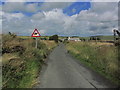
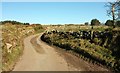
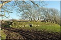
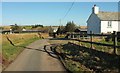
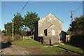
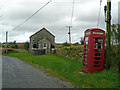
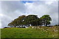
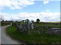
Please click the More button for more images, licensing and image copyright information.
Member of UK Parliament
This postcode is in the North Cornwall parliamentary constituency.
North Cornwall is a constituency in the South West region of England. The seat has been held by Scott Mann (Conservative) since May 2015.

Most Recent House Sales for PL32 9PY
28 Apr 2000
Local Petrol Station Prices
Coordinates for PL32 9PY
Residents at PL32 9PY
Sunrise and Sunset at PL32 9PY
Traffic Emission and Congestion Zones
Historical Weather Summary
| Clear | 18.10% |
| Cloudy | 57.28% |
| Rain | 9.68% |
| Windy | 13.61% |
| Other | 1.33% |
Population
Deprivation Index
the more deprived the postcode
Average Energy Performance
Companies Registered at PL32 9PY
Postcode Details for PL32 9PY
Recent Updates
|
18 Apr 2024 Added Traffic Camera Views from Traffic Scotland to Roadworks within Scotland |
|
15 Apr 2024 Schools Data updated for April 2024 |
|
10 Apr 2024 Companies Data updated for March 2024 |
|
7 Apr 2024 New option to receive automatic updates to roadworks that affect you |
|
7 Apr 2024 Police and Crime data updated for February 2024 |
|
3 Apr 2024 Sold House Price data updated for February 2024 |
|
30 Mar 2024 Energy Performance Certificates (England and Wales) updated February 2024 |
|
28 Mar 2024 New feature to use Geolocating functions to detect your current location |
Random Postcodes
Want an idea of what is in our extensive website? Try somewhere completely random!
The Rural/Urban classification is based upon data collected during the 2011 Census and released in August 2013 and is categorised into 6 distinct classes.
[A] Urban Major conurbation: A built up area with a population of 10,000 (3,000 in Scotland) or more and is assigned to the major conurbation settlement category.
[B] Urban Minor conurbation: A built up area with a population of 10,000 (3,000 in Scotland) or more and is assigned to the minor conurbation settlement category.
[C] Urban City and town: A built up area with a population of 10,000 (3,000 in Scotland) or more and is assigned to the city and town settlement category.
[D] Rural Town and fringe
[E] Rural Village
[F] Rural Hamlet and isolated dwelling
The Index of Multiple Deprivation (IMD) is the official measure of relative deprivation.
The index is based on 39 separate indicators across seven distinct domains (Income; Employment; Health and Disability; Education, Skills and Training; Crime; Barriers to Housing and Services; Living Environment) to provide an overall measure of multiple deprivation and is calculated for every neighbourhood.
The index is relative rather than an absolute scale and so a neighbourhood with a score of 10 is more deprived than one rated 20, but this does not equate to being twice as deprived.
Please note: Different indices are used in England, Scotland, Wales and Northern Ireland and so comparison of scores from neighbourhoods in different countries should not be undertaken.
These figures report on incorporated UK companies only that are registered at this postcode and do not include sole-traders, partnerships or overseas organisations.
The population figure shown for your area are an estimate provided by the Office for National Statistics and is rounded to the nearest 1,000.
The estimates are derived from the Annual Population Survey (APS) which is the Labour Force Survey (LFS) plus various sample boosts.
There are 55 unitary authorities. They provide all local government services in their areas. These are mainly in the cities, urban areas and larger towns although there are now 6 shire county councils that are unitary (ie have no district councils beneath them).