Overview for Kincraig Terrace, INVERNESS, IV3 8RP
Introduction
Inverness is a city in the Scottish Highlands, having been granted city status in 2000. It is the administrative centre for The Highland Council and is regarded as the capital of the Highlands. Historically it served as the county town of the county of Inverness-shire. Inverness lies near two important battle sites: the 11th-century battle of Blàr nam Fèinne against Norway which took place on the Aird, and the 18th century Battle of Culloden which took place on Culloden Moor. It is the northernmost city in the United Kingdom and lies within the Great Glen (Gleann Mòr) at its northeastern extremity where the River Ness enters the Beauly Firth. At the latest, a settlement was established by the 6th century with the first royal charter being granted by Dabíd mac Maíl Choluim (King David I) in the 12th century. Inverness and Inverness-shire are closely linked to various influential clans, including Clan Mackintosh, Clan Fraser and Clan MacKenzie.
The population of Inverness grew from 40,969 in 2001 to 46,969 in 2012, according to World Population Review. The Greater Inverness area, including Culloden and Westhill, had a population of 56,969 in 2012. In 2016, it had a population of 63,320. Inverness is one of Europe's fastest growing cities, with a quarter of the Highland population living in or around it,. In 2008, Inverness was ranked fifth out of 189 British cities for its quality of life, the highest of any Scottish city. Inverness is twinned with one German city, Augsburg, and two French towns, La Baule and Saint-Valery-en-Caux.
In 2014, a survey by a property website described Inverness as the happiest place in Scotland and the second-happiest in the UK. Inverness was again found to be the happiest place in Scotland by a new study conducted in 2015.
Summary for Kincraig Terrace, INVERNESS, IV3 8RP
Roadworks near IV3 8RP
Road Safety near IV3 8RP
Details of personal injury accidents in and around Kincraig Terrace, IV3 8RP that have been reported to over the past 20 years.
Traffic Levels near IV3 8RP
View traffic levels near Kincraig Terrace, IV3 8RP from official Department for Transport counts.
Images taken near to Kincraig Terrace, IV3 8RP and the surrounding area
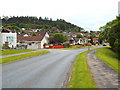
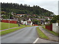
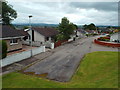
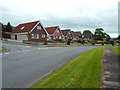
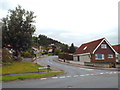
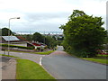
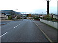
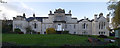
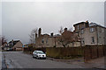
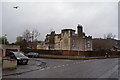
Please click the More button for more images, licensing and image copyright information.
Member of UK Parliament
This postcode is in the Inverness, Nairn, Badenoch and Strathspey parliamentary constituency.
Inverness, Nairn, Badenoch and Strathspey is a constituency in Scotland. The seat has been held by Drew Hendry (Scottish National Party) since May 2015.

Most Recent House Sales for Kincraig Terrace, IV3 8RP
No recorded house sales or transfers for this postcode.
Local Petrol Station Prices
Coordinates for IV3 8RP
Sunrise and Sunset at IV3 8RP
Traffic Emission and Congestion Zones
Historical Weather Summary
| Clear | 8.03% |
| Cloudy | 66.86% |
| Rain | 6.61% |
| Windy | 17.74% |
| Other | 0.76% |
Average Energy Performance
Companies Registered at IV3 8RP
Postcode Details for IV3 8RP
Recent Updates
|
18 Apr 2024 Added Traffic Camera Views from Traffic Scotland to Roadworks within Scotland |
|
15 Apr 2024 Schools Data updated for April 2024 |
|
10 Apr 2024 Companies Data updated for March 2024 |
|
7 Apr 2024 New option to receive automatic updates to roadworks that affect you |
|
7 Apr 2024 Police and Crime data updated for February 2024 |
|
3 Apr 2024 Sold House Price data updated for February 2024 |
|
30 Mar 2024 Energy Performance Certificates (England and Wales) updated February 2024 |
|
28 Mar 2024 New feature to use Geolocating functions to detect your current location |
Random Postcodes
Want an idea of what is in our extensive website? Try somewhere completely random!
The Rural/Urban classification is based upon data collected during the 2011 Census and released in August 2013 and is categorised into 6 distinct classes.
[A] Urban Major conurbation: A built up area with a population of 10,000 (3,000 in Scotland) or more and is assigned to the major conurbation settlement category.
[B] Urban Minor conurbation: A built up area with a population of 10,000 (3,000 in Scotland) or more and is assigned to the minor conurbation settlement category.
[C] Urban City and town: A built up area with a population of 10,000 (3,000 in Scotland) or more and is assigned to the city and town settlement category.
[D] Rural Town and fringe
[E] Rural Village
[F] Rural Hamlet and isolated dwelling
The Index of Multiple Deprivation (IMD) is the official measure of relative deprivation.
The index is based on 39 separate indicators across seven distinct domains (Income; Employment; Health and Disability; Education, Skills and Training; Crime; Barriers to Housing and Services; Living Environment) to provide an overall measure of multiple deprivation and is calculated for every neighbourhood.
The index is relative rather than an absolute scale and so a neighbourhood with a score of 10 is more deprived than one rated 20, but this does not equate to being twice as deprived.
Please note: Different indices are used in England, Scotland, Wales and Northern Ireland and so comparison of scores from neighbourhoods in different countries should not be undertaken.
These figures report on incorporated UK companies only that are registered at this postcode and do not include sole-traders, partnerships or overseas organisations.
The population figure shown for your area are an estimate provided by the Office for National Statistics and is rounded to the nearest 1,000.
The estimates are derived from the Annual Population Survey (APS) which is the Labour Force Survey (LFS) plus various sample boosts.
There are 55 unitary authorities. They provide all local government services in their areas. These are mainly in the cities, urban areas and larger towns although there are now 6 shire county councils that are unitary (ie have no district councils beneath them).