Muirtown House
Introduction
The photograph on this page of Muirtown House by Richard Dorrell as part of the Geograph project.
The Geograph project started in 2005 with the aim of publishing, organising and preserving representative images for every square kilometre of Great Britain, Ireland and the Isle of Man.

There are currently over 7.5m images from over 14,400 individuals and you can help contribute to the project by visiting https://www.geograph.org.uk
Muirtown House
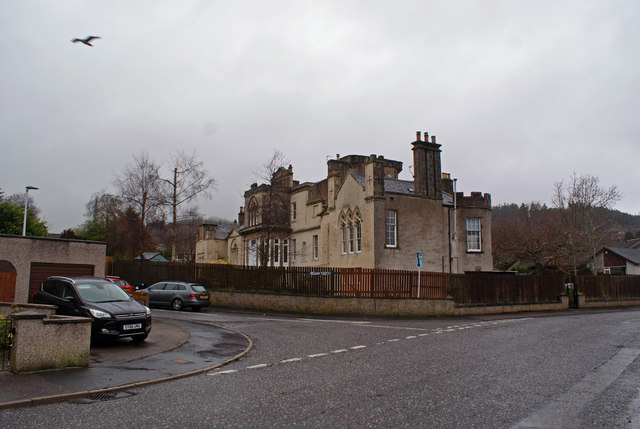
Image: © Richard Dorrell Taken: 6 Mar 2019
This category B listed early 19th century mansion stands incongruously in the midst of a modern bungalow housing estate. The roads are Firthview Road, with Charlston Place leading off. Muirtown House was built by Major Hugh Robert Duff, and begun in 1800, but various alterations and additions, in different architectural styles, were made to it between then and 1851. The house is now subdivided into eight separate private dwellings. Rear view: Image Firthview Road (looking the other way) Image
Images are licensed for reuse under creativecommons.org/licenses/by-sa/2.0
Image Location
Latitude
57.483809
Longitude
-4.25293