Overview for Kendal Crescent, ALNESS, IV17 0UQ
Introduction
Alness is a town and civil parish in Ross and Cromarty, Scotland. It lies near the mouth of the River Averon, near the Cromarty Firth, with the town of Invergordon 3 miles (5 km) to the east, and the village of Evanton 4 miles (6 km) to the south-west. The parish has a population of 5,310, although the census locality, which includes part of the parish of Rosskeen, has a population of 5,186.
According to the Highland Council, the population of Alness has increased by around 20% since the last census in 2011. The population as of 2016 was 6,101.
For most of the 1990s and early 2000s, Alness regularly entered and won flower competitions such as Scotland in Bloom, Britain in Bloom and others, winning many awards. This helped regenerate many areas of the town, with housing estates winning separate awards.
They have not entered in recent years due to the financial costs. The town is still adorned by flowers maintained by volunteers.
In 2018, the town was crowned the Scottish Champion at the 2018 Great British High Street Awards. The judges visited the shortlisted high streets across England, Scotland, Wales and Northern Ireland, meeting local businesses, shoppers and community organisations, with Alness impressing with its reinvention over the years to become a place to find everything from florists and bridal wear to delis and bakeries.
Summary for Kendal Crescent, ALNESS, IV17 0UQ
Roadworks near IV17 0UQ
Road Safety near IV17 0UQ
Details of personal injury accidents in and around Kendal Crescent, IV17 0UQ that have been reported to over the past 20 years.
Traffic Levels near IV17 0UQ
View traffic levels near Kendal Crescent, IV17 0UQ from official Department for Transport counts.
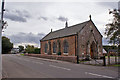
Images taken near to Kendal Crescent, IV17 0UQ and the surrounding area

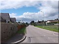
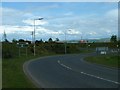
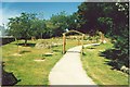
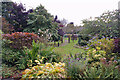
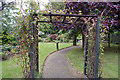
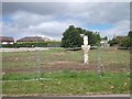
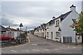
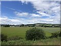
Please click the More button for more images, licensing and image copyright information.
Member of UK Parliament
This postcode is in the Caithness, Sutherland and Easter Ross parliamentary constituency.
Caithness, Sutherland and Easter Ross is a constituency in Scotland. The seat has been held by Jamie Stone (Liberal Democrat) since June 2017.

Most Recent House Sales for Kendal Crescent, IV17 0UQ
No recorded house sales or transfers for this postcode.
Local Petrol Station Prices
Coordinates for IV17 0UQ
Sunrise and Sunset at IV17 0UQ
Traffic Emission and Congestion Zones
Historical Weather Summary
| Clear | 8.11% |
| Cloudy | 63.82% |
| Rain | 7.61% |
| Windy | 18.82% |
| Other | 1.64% |
Companies Registered at IV17 0UQ
Postcode Details for IV17 0UQ
Recent Updates
|
18 Apr 2024 Added Traffic Camera Views from Traffic Scotland to Roadworks within Scotland |
|
15 Apr 2024 Schools Data updated for April 2024 |
|
10 Apr 2024 Companies Data updated for March 2024 |
|
7 Apr 2024 New option to receive automatic updates to roadworks that affect you |
|
7 Apr 2024 Police and Crime data updated for February 2024 |
|
3 Apr 2024 Sold House Price data updated for February 2024 |
|
30 Mar 2024 Energy Performance Certificates (England and Wales) updated February 2024 |
|
28 Mar 2024 New feature to use Geolocating functions to detect your current location |
Random Postcodes
Want an idea of what is in our extensive website? Try somewhere completely random!
The Rural/Urban classification is based upon data collected during the 2011 Census and released in August 2013 and is categorised into 6 distinct classes.
[A] Urban Major conurbation: A built up area with a population of 10,000 (3,000 in Scotland) or more and is assigned to the major conurbation settlement category.
[B] Urban Minor conurbation: A built up area with a population of 10,000 (3,000 in Scotland) or more and is assigned to the minor conurbation settlement category.
[C] Urban City and town: A built up area with a population of 10,000 (3,000 in Scotland) or more and is assigned to the city and town settlement category.
[D] Rural Town and fringe
[E] Rural Village
[F] Rural Hamlet and isolated dwelling
The Index of Multiple Deprivation (IMD) is the official measure of relative deprivation.
The index is based on 39 separate indicators across seven distinct domains (Income; Employment; Health and Disability; Education, Skills and Training; Crime; Barriers to Housing and Services; Living Environment) to provide an overall measure of multiple deprivation and is calculated for every neighbourhood.
The index is relative rather than an absolute scale and so a neighbourhood with a score of 10 is more deprived than one rated 20, but this does not equate to being twice as deprived.
Please note: Different indices are used in England, Scotland, Wales and Northern Ireland and so comparison of scores from neighbourhoods in different countries should not be undertaken.
These figures report on incorporated UK companies only that are registered at this postcode and do not include sole-traders, partnerships or overseas organisations.
The population figure shown for your area are an estimate provided by the Office for National Statistics and is rounded to the nearest 1,000.
The estimates are derived from the Annual Population Survey (APS) which is the Labour Force Survey (LFS) plus various sample boosts.
There are 55 unitary authorities. They provide all local government services in their areas. These are mainly in the cities, urban areas and larger towns although there are now 6 shire county councils that are unitary (ie have no district councils beneath them).