Overview for Coombe Bottom, GUILDFORD, GU5 9TD
Introduction
Guildford is a town in west Surrey, England, around 27 mi (43 km) southwest of central London. As of the 2011 census, the town has a population of about 77,000 and is the seat of the wider Borough of Guildford, which had around 143,650 inhabitants in mid-2019 est.. The name "Guildford" is thought to derive from a crossing of the River Wey, a tributary of the River Thames that flows through the town centre.
The earliest evidence of human activity in the area is from the Mesolithic and Guildford is mentioned in the will of Alfred the Great from c. 880. The exact location of the main Anglo-Saxon settlement is unclear and the current site of the modern town centre may not have been occupied until the early 11th century. Following the Norman Conquest, a motte-and-bailey castle was constructed, which was developed into a royal residence by Henry III. During the late Middle Ages, Guildford prospered as a result of the wool trade and the town was granted a charter of incorporation by Henry VII in 1488.
The River Wey Navigation between Guildford and the Thames was opened in 1653, facilitating the transport of produce, building materials and manufactured items to new markets in London. The arrival of the railways in the 1840s attracted further investment and the town began to grow with the construction of its first new suburb at Charlotteville in the 1860s. The town became the centre of a new Anglican diocese in 1927 and the foundation stone of the cathedral was laid in 1936. Guildford became a university town in September 1966, when the University of Surrey was established by Royal Charter.
Guildford is surrounded on three sides by the Surrey Hills Area of Outstanding Natural Beauty, which severely limits its potential for expansion to the east, west and south. Recent development has been focused to the north of the town in the direction of Woking. Guildford now officially forms the southwestern tip of the Greater London Built-up Area, as defined by the Office for National Statistics.
Summary for Coombe Bottom, GUILDFORD, GU5 9TD
Roadworks near GU5 9TD
Road Safety near GU5 9TD
Details of personal injury accidents in and around Coombe Bottom, GU5 9TD that have been reported to Surrey Police over the past 20 years.
Traffic Levels near GU5 9TD
View traffic levels near Coombe Bottom, GU5 9TD from official Department for Transport counts.
Images taken near to Coombe Bottom, GU5 9TD and the surrounding area
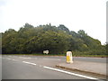
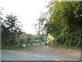
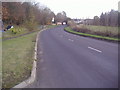
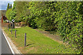
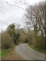
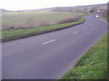
Please click the More button for more images, licensing and image copyright information.
Guildford and nearby Videos From YouTube
amazing drone footage of borough green
Borough Green is situated in the borough of Tonbridge and Malling in Kent, England. The central area is situated on the A25 road ...
Channel: rollybentulan (View Channel)
Published: 26 Jan 2022
Member of UK Parliament
This postcode is in the Mole Valley parliamentary constituency.
Mole Valley is a constituency in the South East region of England. The seat has been held by Sir Paul Beresford (Conservative) since May 2010.

Most Recent House Sales for Coombe Bottom, GU5 9TD
No recorded house sales or transfers for this postcode.
Local Petrol Station Prices
Coordinates for GU5 9TD
Residents at GU5 9TD
Sunrise and Sunset at GU5 9TD
Traffic Emission and Congestion Zones
Historical Weather Summary
| Clear | 22.96% |
| Cloudy | 66.84% |
| Rain | 6.96% |
| Windy | 3.03% |
| Other | 0.21% |
Population
Deprivation Index
the more deprived the postcode
Average Energy Performance
Companies Registered at GU5 9TD
Postcode Details for GU5 9TD
Recent Updates
|
18 Apr 2024 Added Traffic Camera Views from Traffic Scotland to Roadworks within Scotland |
|
15 Apr 2024 Schools Data updated for April 2024 |
|
10 Apr 2024 Companies Data updated for March 2024 |
|
7 Apr 2024 New option to receive automatic updates to roadworks that affect you |
|
7 Apr 2024 Police and Crime data updated for February 2024 |
|
3 Apr 2024 Sold House Price data updated for February 2024 |
|
30 Mar 2024 Energy Performance Certificates (England and Wales) updated February 2024 |
|
28 Mar 2024 New feature to use Geolocating functions to detect your current location |
Random Postcodes
Want an idea of what is in our extensive website? Try somewhere completely random!
The Rural/Urban classification is based upon data collected during the 2011 Census and released in August 2013 and is categorised into 6 distinct classes.
[A] Urban Major conurbation: A built up area with a population of 10,000 (3,000 in Scotland) or more and is assigned to the major conurbation settlement category.
[B] Urban Minor conurbation: A built up area with a population of 10,000 (3,000 in Scotland) or more and is assigned to the minor conurbation settlement category.
[C] Urban City and town: A built up area with a population of 10,000 (3,000 in Scotland) or more and is assigned to the city and town settlement category.
[D] Rural Town and fringe
[E] Rural Village
[F] Rural Hamlet and isolated dwelling
The Index of Multiple Deprivation (IMD) is the official measure of relative deprivation.
The index is based on 39 separate indicators across seven distinct domains (Income; Employment; Health and Disability; Education, Skills and Training; Crime; Barriers to Housing and Services; Living Environment) to provide an overall measure of multiple deprivation and is calculated for every neighbourhood.
The index is relative rather than an absolute scale and so a neighbourhood with a score of 10 is more deprived than one rated 20, but this does not equate to being twice as deprived.
Please note: Different indices are used in England, Scotland, Wales and Northern Ireland and so comparison of scores from neighbourhoods in different countries should not be undertaken.
These figures report on incorporated UK companies only that are registered at this postcode and do not include sole-traders, partnerships or overseas organisations.
The population figure shown for your area are an estimate provided by the Office for National Statistics and is rounded to the nearest 1,000.
The estimates are derived from the Annual Population Survey (APS) which is the Labour Force Survey (LFS) plus various sample boosts.
There are 26 county councils in 2-tier areas, providing services such as education, social services and waste disposal.
In 2-tier areas, each county council area is subdivided into districts, for which there is an independent district council. There are 192 district councils.
District councils are responsible for local services such as rubbish collection, housing and planning applications.