Overview for Malin Close, BURTON-ON-TRENT, DE14 2FP
Introduction
Burton upon Trent, also known as Burton-on-Trent or simply Burton, is a market town in the borough of East Staffordshire in the county of Staffordshire, England, close to the border with Derbyshire. In 2021, it had a population of 76,270. The demonym for residents of the town is Burtonian. Burton is located 11 miles (18 km) south-west of Derby, 27 miles (43 km) north-west of Leicester, 28 miles (45 km) west-south-west of Nottingham and 20 miles (32 km) south of the southern entrance to the Peak District National Park.
Burton is known for its brewing. The town grew up around Burton Abbey. Burton Bridge was also the site of two battles, in 1322, when Edward II defeated the rebel Earl of Lancaster and in 1643 when royalists captured the town during the First English Civil War. William Lord Paget and his descendants were responsible for extending the manor house within the abbey grounds and facilitating the extension of the River Trent Navigation to Burton. Burton grew into a busy market town by the early modern period.
The town is served by Burton-on-Trent railway station. The town was also the start and terminus of the now defunct South Staffordshire Line which linked it to Lichfield, Walsall, Dudley and Stourbridge.
Summary for Malin Close, BURTON-ON-TRENT, DE14 2FP
Roadworks near DE14 2FP
Road Safety near DE14 2FP
Details of personal injury accidents in and around Malin Close, DE14 2FP that have been reported to Staffordshire Police over the past 20 years.
Traffic Levels near DE14 2FP
View traffic levels near Malin Close, DE14 2FP from official Department for Transport counts.
Images taken near to Malin Close, DE14 2FP and the surrounding area
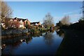
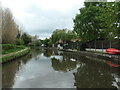
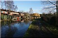
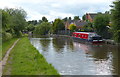
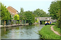

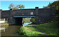
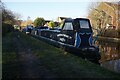
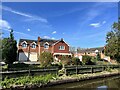
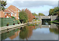
Please click the More button for more images, licensing and image copyright information.
Police
This area is policed by Staffordshire Police.
Staffordshire Police split their policing area into 97 separate neighbourhoods and this postcode is in the Burton Urban neighbourhood.

Burton Urban Neighbourhood Crime
Top 3 Categories
For full details of all categories together with more crime information, click on the Details button.
Member of UK Parliament
This postcode is in the Burton parliamentary constituency.
Burton is a constituency in the West Midlands region of England. The seat has been held by Kate Kniveton (Conservative) since December 2019.

Most Recent House Sales for Malin Close, DE14 2FP
27 Aug 2021
15 Jul 2021
4 Mar 2021
27 Apr 2018
Local Petrol Station Prices
Coordinates for DE14 2FP
Residents at DE14 2FP
Sunrise and Sunset at DE14 2FP
Traffic Emission and Congestion Zones
Historical Weather Summary
| Clear | 7.75% |
| Cloudy | 65.13% |
| Rain | 8.83% |
| Windy | 18.29% |
| Other | 0.00% |
Population
Deprivation Index
the more deprived the postcode
Average Energy Performance
Companies Registered at DE14 2FP
Postcode Details for DE14 2FP
Recent Updates
|
18 Apr 2024 Added Traffic Camera Views from Traffic Scotland to Roadworks within Scotland |
|
15 Apr 2024 Schools Data updated for April 2024 |
|
10 Apr 2024 Companies Data updated for March 2024 |
|
7 Apr 2024 New option to receive automatic updates to roadworks that affect you |
|
7 Apr 2024 Police and Crime data updated for February 2024 |
|
3 Apr 2024 Sold House Price data updated for February 2024 |
|
30 Mar 2024 Energy Performance Certificates (England and Wales) updated February 2024 |
|
28 Mar 2024 New feature to use Geolocating functions to detect your current location |
Random Postcodes
Want an idea of what is in our extensive website? Try somewhere completely random!
The Rural/Urban classification is based upon data collected during the 2011 Census and released in August 2013 and is categorised into 6 distinct classes.
[A] Urban Major conurbation: A built up area with a population of 10,000 (3,000 in Scotland) or more and is assigned to the major conurbation settlement category.
[B] Urban Minor conurbation: A built up area with a population of 10,000 (3,000 in Scotland) or more and is assigned to the minor conurbation settlement category.
[C] Urban City and town: A built up area with a population of 10,000 (3,000 in Scotland) or more and is assigned to the city and town settlement category.
[D] Rural Town and fringe
[E] Rural Village
[F] Rural Hamlet and isolated dwelling
The Index of Multiple Deprivation (IMD) is the official measure of relative deprivation.
The index is based on 39 separate indicators across seven distinct domains (Income; Employment; Health and Disability; Education, Skills and Training; Crime; Barriers to Housing and Services; Living Environment) to provide an overall measure of multiple deprivation and is calculated for every neighbourhood.
The index is relative rather than an absolute scale and so a neighbourhood with a score of 10 is more deprived than one rated 20, but this does not equate to being twice as deprived.
Please note: Different indices are used in England, Scotland, Wales and Northern Ireland and so comparison of scores from neighbourhoods in different countries should not be undertaken.
These figures report on incorporated UK companies only that are registered at this postcode and do not include sole-traders, partnerships or overseas organisations.
The population figure shown for your area are an estimate provided by the Office for National Statistics and is rounded to the nearest 1,000.
The estimates are derived from the Annual Population Survey (APS) which is the Labour Force Survey (LFS) plus various sample boosts.
There are 26 county councils in 2-tier areas, providing services such as education, social services and waste disposal.
In 2-tier areas, each county council area is subdivided into districts, for which there is an independent district council. There are 192 district councils.
District councils are responsible for local services such as rubbish collection, housing and planning applications.