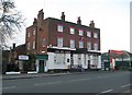
Overview for North Road, SOUTHALL, UB1 2JQ
Introduction
Southall is a large suburban town in West London, England, part of the London Borough of Ealing and is one of its seven major towns.
It is situated 10.7 mi (17.2 km) west of Charing Cross and had a population of 69,857 as of 2011. It is generally divided in three parts: the mostly residential area around Lady Margaret Road (Dormers Wells); the main commercial centre at High Street and Southall Broadway (part of the greater Uxbridge Road); and Old Southall/Southall Green to the south consisting of Southall railway station, industries and Norwood Green bounded by the M4.
It was historically a municipal borough of Middlesex administered from Southall Town Hall until 1965. Southall is located on the Grand Union Canal (formerly the Grand Junction Canal) which first linked London with the rest of the growing canal system. It was one of the last canals to carry significant commercial traffic (through the 1950s) and is still open to traffic and is used by pleasure craft. The canal separates it from Hayes on the west, whereas to the east the River Brent separates the town from Hanwell.
From the 1950s the town's local factories and proximity to Heathrow Airport attracted large numbers of Asian immigrants; the town eventually became home to the largest Punjabi community outside the Indian subcontinent and is today a major centre of South Asian culture, having gained the nickname Little India.
Summary for North Road, SOUTHALL, UB1 2JQ
Roadworks near UB1 2JQ
Road Safety near UB1 2JQ
Details of personal injury accidents in and around North Road, UB1 2JQ that have been reported to Metropolitan Police Service over the past 20 years.
Traffic Levels near UB1 2JQ
View traffic levels near North Road, UB1 2JQ from official Department for Transport counts.
Images taken near to North Road, UB1 2JQ and the surrounding area
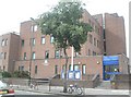
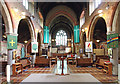


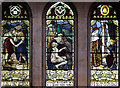
Please click the More button for more images, licensing and image copyright information.
Member of UK Parliament
This postcode is in the Ealing, Southall parliamentary constituency.
Ealing, Southall is a constituency in London, England. The seat has been held by Mr Virendra Sharma (Labour) since May 2010.

Most Recent House Sales for North Road, UB1 2JQ
No recorded house sales or transfers for this postcode.
Local Petrol Station Prices
Coordinates for UB1 2JQ
Residents at UB1 2JQ
Sunrise and Sunset at UB1 2JQ
Traffic Emission Zones
Historical Weather Summary
| Clear | 9.13% |
| Cloudy | 80.63% |
| Rain | 7.96% |
| Windy | 2.21% |
| Other | 0.07% |
Population
Deprivation Index
the more deprived the postcode
Average Energy Performance
Companies Registered at UB1 2JQ
Postcode Details for UB1 2JQ
Recent Updates
|
18 Apr 2024 Added Traffic Camera Views from Traffic Scotland to Roadworks within Scotland |
|
15 Apr 2024 Schools Data updated for April 2024 |
|
10 Apr 2024 Companies Data updated for March 2024 |
|
7 Apr 2024 New option to receive automatic updates to roadworks that affect you |
|
7 Apr 2024 Police and Crime data updated for February 2024 |
|
3 Apr 2024 Sold House Price data updated for February 2024 |
|
30 Mar 2024 Energy Performance Certificates (England and Wales) updated February 2024 |
|
28 Mar 2024 New feature to use Geolocating functions to detect your current location |
Random Postcodes
Want an idea of what is in our extensive website? Try somewhere completely random!
The Rural/Urban classification is based upon data collected during the 2011 Census and released in August 2013 and is categorised into 6 distinct classes.
[A] Urban Major conurbation: A built up area with a population of 10,000 (3,000 in Scotland) or more and is assigned to the major conurbation settlement category.
[B] Urban Minor conurbation: A built up area with a population of 10,000 (3,000 in Scotland) or more and is assigned to the minor conurbation settlement category.
[C] Urban City and town: A built up area with a population of 10,000 (3,000 in Scotland) or more and is assigned to the city and town settlement category.
[D] Rural Town and fringe
[E] Rural Village
[F] Rural Hamlet and isolated dwelling
The Index of Multiple Deprivation (IMD) is the official measure of relative deprivation.
The index is based on 39 separate indicators across seven distinct domains (Income; Employment; Health and Disability; Education, Skills and Training; Crime; Barriers to Housing and Services; Living Environment) to provide an overall measure of multiple deprivation and is calculated for every neighbourhood.
The index is relative rather than an absolute scale and so a neighbourhood with a score of 10 is more deprived than one rated 20, but this does not equate to being twice as deprived.
Please note: Different indices are used in England, Scotland, Wales and Northern Ireland and so comparison of scores from neighbourhoods in different countries should not be undertaken.
These figures report on incorporated UK companies only that are registered at this postcode and do not include sole-traders, partnerships or overseas organisations.
The population figure shown for your area are an estimate provided by the Office for National Statistics and is rounded to the nearest 1,000.
The estimates are derived from the Annual Population Survey (APS) which is the Labour Force Survey (LFS) plus various sample boosts.
There are 32 London boroughs. They provide nearly all the services in their area. However, the Greater London Authority (GLA) provides London-wide government, including special responsibility for police, fire, strategic planning and transport.