
IMAGES TAKEN NEAR TO
Railway Cottages, SELBY, YO8 8EZ
Introduction
This page details the photographs taken nearby to Railway Cottages, YO8 8EZ by members of the Geograph project.
The Geograph project started in 2005 with the aim of publishing, organising and preserving representative images for every square kilometre of Great Britain, Ireland and the Isle of Man.

There are currently over 7.5m images from over14,400 individuals and you can help contribute to the project by visiting https://www.geograph.org.uk
Image Map
Images are licensed for reuse under creativecommons.org/licenses/by-sa/2.0
Notes
- Clicking on the map will re-center to the selected point.
- The higher the marker number, the further away the image location is from the centre of the postcode.
Image Listing (15 Images Found)
Images are licensed for reuse under creativecommons.org/licenses/by-sa/2.0
Image
Details
Distance

2
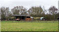
Barns near to Barlow
The barns lie to the east of Barlow Road and south of the village of Barlow, close to Selby; the route of an old railway runs behind them.
Image: © Trevor Littlewood
Taken: 5 Mar 2017
0.05 miles
3

Barlow Station
View NW, towards Selby; Selby - Goole branch, closed to passengers 15/6/64, to Goods 7/12/64. Crossing-gates operated from adjacent signalbox.
Image: © Ben Brooksbank
Taken: 23 Apr 1961
0.05 miles

6

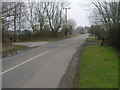
Farmland beside Barlow Road
In the distance is Drax power station which dominates this landscape.
Image: © DS Pugh
Taken: 20 Apr 2019
0.08 miles
7
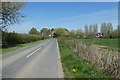
Barlow Road
Looking along Barlow Road leading to the village of Barlow.
Image: © DS Pugh
Taken: 20 Apr 2019
0.09 miles
8
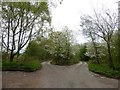
Dual carriageway access to the car park at Barlow Common Nature Reserve
The reserve was created on a former railway ballast tip
Image: © Graham Hogg
Taken: 24 Apr 2018
0.10 miles
9
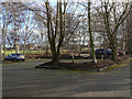
Barlow Common Car Park
The area was originally railway sidings, serving a ballast spoil tip..
Image: © Alan Murray-Rust
Taken: 26 Dec 2011
0.13 miles
10

Mill House
The oldest available OS maps do not indicate what sort of mill might have been here, although wind rather than water seems more likely.
Image: © Alan Murray-Rust
Taken: 26 Dec 2011
0.14 miles