IMAGES TAKEN NEAR TO
Gardeners Lane, SELBY, YO8 5NL
Introduction
This page details the photographs taken nearby to Gardeners Lane, YO8 5NL by members of the Geograph project.
The Geograph project started in 2005 with the aim of publishing, organising and preserving representative images for every square kilometre of Great Britain, Ireland and the Isle of Man.

There are currently over 7.5m images from over14,400 individuals and you can help contribute to the project by visiting https://www.geograph.org.uk
Image Map
Images are licensed for reuse under creativecommons.org/licenses/by-sa/2.0
Notes
- Clicking on the map will re-center to the selected point.
- The higher the marker number, the further away the image location is from the centre of the postcode.
Image Listing (33 Images Found)
Images are licensed for reuse under creativecommons.org/licenses/by-sa/2.0
Image
Details
Distance
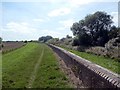
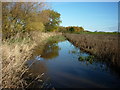
3
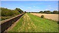
Path along top of River Ouse flood bank
Image: © Chris Morgan
Taken: 30 Aug 2016
0.10 miles
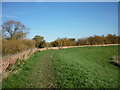
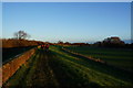
4
This is the way but! #1
The high tide on the River Ouse has made it impossible to continue.
Image: © Ian S
Taken: 6 Nov 2010
0.10 miles
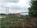
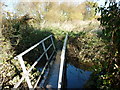
7
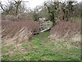
Rickety footbridge
Follow the footpath at this point to Turnhead farm
Image: © Malcolm Campbell
Taken: 21 Feb 2008
0.11 miles
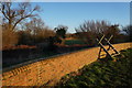
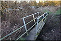
8
This is the way but! #2
The high tide has flooded the footpath making it impossible for me to continue.
Image: © Ian S
Taken: 6 Nov 2010
0.11 miles