IMAGES TAKEN NEAR TO
North Kilvington, THIRSK, YO7 4AF

Introduction

This page details the photographs taken nearby to YO7 4AF by members of the Geograph project.

The Geograph project started in 2005 with the aim of publishing, organising and preserving representative images for every square kilometre of Great Britain, Ireland and the Isle of Man.

There are currently over 7.5m images from over14,400 individuals and you can help contribute to the project by visiting https://www.geograph.org.uk

Image Map


Images are licensed for reuse under creativecommons.org/licenses/by-sa/2.0
Notes
  • Clicking on the map will re-center to the selected point.
  • The higher the marker number, the further away the image location is from the centre of the postcode.

Image Listing (7 Images Found)

Images are licensed for reuse under creativecommons.org/licenses/by-sa/2.0
Image
Details
Distance
1
Moorhouse Lane, North Kilvington
A quiet backwater, close to the busy A19 dual carriageway.
Image: © Gordon Hatton Taken: 28 Mar 2007
0.05 miles
2
Dwelling at Chapel Farm, North Kilvington
Image: © Chris Heaton Taken: 22 Jan 2018
0.15 miles
3
Slippery Surface on Moorhouse Lane
Quiet country lane that runs north west from the A19 towards Thornton-le-Street
Image: © Chris Heaton Taken: 22 Jan 2018
0.16 miles
4
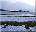
Parallel lines
A field by the A19 at North Kilvington where old ridge and furrow lines are enhanced by the snow cover.
Image: © Gordon Hatton Taken: 8 Feb 2012
0.16 miles
5
Ordnance Survey Flush Bracket G3282
This can be found on the wall of a farm building at Chapel Farm, North Kilvington. For more detail see : http://www.bench-marks.org.uk/bm15224
Image: © Peter Wood Taken: 1 Sep 2015
0.17 miles
6
Chapel Farm at North Kilvington
Looking westward.
Image: © Peter Wood Taken: 1 Sep 2015
0.17 miles
7
A19 - Moorhouse Lane turning ahead
There is also a turning for Chapel Farm before Moorhouse Lane, but only the one sign.
Image: © Robin Webster Taken: 7 Oct 2011
0.23 miles