IMAGES TAKEN NEAR TO
Islebeck, THIRSK, YO7 3AN
Introduction
This page details the photographs taken nearby to YO7 3AN by members of the Geograph project.
The Geograph project started in 2005 with the aim of publishing, organising and preserving representative images for every square kilometre of Great Britain, Ireland and the Isle of Man.

There are currently over 7.5m images from over14,400 individuals and you can help contribute to the project by visiting https://www.geograph.org.uk
Image Map
Images are licensed for reuse under creativecommons.org/licenses/by-sa/2.0
Notes
- Clicking on the map will re-center to the selected point.
- The higher the marker number, the further away the image location is from the centre of the postcode.
Image Listing (16 Images Found)
Images are licensed for reuse under creativecommons.org/licenses/by-sa/2.0
Image
Details
Distance
1
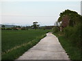
Track to Keeper's Cottage
Farm track on the boundary of Sowerby and Dalton parishes. The spire of Thirkleby church can be seen in the distance.
Image: © Gordon Hatton
Taken: 26 Apr 2007
0.03 miles
3
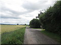
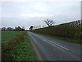
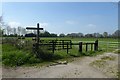
Track to Oaklea and Keeper's Cottage
From the junction with Sandy Lane.
Image: © Christine Johnstone
Taken: 19 Aug 2010
0.13 miles
4
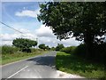
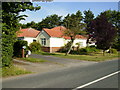
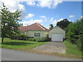
Sandy Lane
Looking north from Green Acre towards Lansdowne.
Image: © Christine Johnstone
Taken: 19 Aug 2010
0.13 miles
5
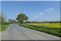
Rape beside Sandy Lane
With a collection of wheelie bins beside the tree.
Image: © DS Pugh
Taken: 5 May 2018
0.13 miles
9
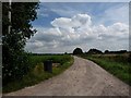
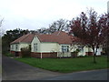
Green Acre
Looking across a paddock beside Sandy Lane.
Image: © DS Pugh
Taken: 5 May 2018
0.15 miles