IMAGES TAKEN NEAR TO
Islebeck Road, THIRSK, YO7 3AL
Introduction
This page details the photographs taken nearby to Islebeck Road, YO7 3AL by members of the Geograph project.
The Geograph project started in 2005 with the aim of publishing, organising and preserving representative images for every square kilometre of Great Britain, Ireland and the Isle of Man.

There are currently over 7.5m images from over14,400 individuals and you can help contribute to the project by visiting https://www.geograph.org.uk
Image Map (Loading...)


Getting Data...Please wait
Leaflet Map data © OpenStreetMap
Images are licensed for reuse under creativecommons.org/licenses/by-sa/2.0
Notes
- Clicking on the map will re-center to the selected point.
- The higher the marker number, the further away the image location is from the centre of the postcode.
Image Listing (14 Images Found)
Images are licensed for reuse under creativecommons.org/licenses/by-sa/2.0
Image
Details
Distance
1

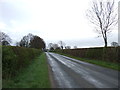
Moor End Lane
Approaching The Beeches to the south of Thirsk.
Image: © DS Pugh
Taken: 5 May 2018
0.04 miles

4

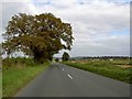
Hedgerow along Moor End Lane
Looking along the road leading into Sowerby.
Image: © DS Pugh
Taken: 5 May 2018
0.09 miles


10
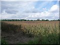
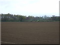
Bean field, off Sandy Lane
Presumably being grown for seed, as the crop has dried out.
Image: © Christine Johnstone
Taken: 19 Aug 2010
0.22 miles