
IMAGES TAKEN NEAR TO
Hambleton, THIRSK, YO7 2HB
Introduction
This page details the photographs taken nearby to YO7 2HB by members of the Geograph project.
The Geograph project started in 2005 with the aim of publishing, organising and preserving representative images for every square kilometre of Great Britain, Ireland and the Isle of Man.

There are currently over 7.5m images from over14,400 individuals and you can help contribute to the project by visiting https://www.geograph.org.uk
Image Map
Images are licensed for reuse under creativecommons.org/licenses/by-sa/2.0
Notes
- Clicking on the map will re-center to the selected point.
- The higher the marker number, the further away the image location is from the centre of the postcode.
Image Listing (8 Images Found)
Images are licensed for reuse under creativecommons.org/licenses/by-sa/2.0
Image
Details
Distance
2

Thirsk 7
Old milepost on the A.170 near to Cold Kirby, North Yorkshire. For close up view see http://www.geograph.org.uk/photo/4773375
Image: © Keith Evans
Taken: 25 Jun 2015
0.14 miles
3

Old Milestone, on the A170, opp Scawton Moor Plantation
Located on the South side of road, on verge in line with new fence across field to farm. Cast iron post, NRYCC casting design, 19th century. Alternative views see http://www.geograph.org.uk/photo/4773375 & http://www.geograph.org.uk/photo/4773379 & http://www.geograph.org.uk/photo/1147951
Inscription reads: THIRSK / 7 // HELMSLEY / 7 // NRYCC // F MATTISON & Co / BEDALE. YORKS//.
Grade II listed by Historic England.
Milestone Society National ID: YN_TKHM07
Image: © Christine Minto
Taken: 4 Feb 2006
0.16 miles
4
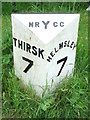
Old Milepost
Old milepost on the A.170 near to Cold Kirby, North Yorkshire. For overall view see http://www.geograph.org.uk/photo/4773379
Image: © Keith Evans
Taken: 25 Jun 2015
0.17 miles
5

A170 Milepost
Spring Cottage Farm is in the background.
Image: © David Rogers
Taken: 4 Feb 2009
0.17 miles
6

Walkers on the Cleveland Way
This photograph shows the route of the Cleveland Way long-distance walk as it passes the Hambleton Inn (Image) on the A170 road. The trees in the background of the photograph are part of Scawton Moor Plantation.
Image: © Philip Barker
Taken: 15 Nov 2009
0.23 miles
7

On Oldstead Moor Looking towards Hambleton Inn
The A170 runs hidden behind the fields and in front of the woods visible in the middle distance.
Image: © Robert Brown
Taken: 12 Aug 2006
0.23 miles
8
Cleveland Way at Hambleton
Following a route with public access along a track towards Hambleton House.
Image: © Derek Harper
Taken: 29 Dec 2015
0.24 miles