IMAGES TAKEN NEAR TO
Boltby, THIRSK, YO7 2DZ
Introduction
This page details the photographs taken nearby to YO7 2DZ by members of the Geograph project.
The Geograph project started in 2005 with the aim of publishing, organising and preserving representative images for every square kilometre of Great Britain, Ireland and the Isle of Man.

There are currently over 7.5m images from over14,400 individuals and you can help contribute to the project by visiting https://www.geograph.org.uk
Image Map
Images are licensed for reuse under creativecommons.org/licenses/by-sa/2.0
Notes
- Clicking on the map will re-center to the selected point.
- The higher the marker number, the further away the image location is from the centre of the postcode.
Image Listing (19 Images Found)
Images are licensed for reuse under creativecommons.org/licenses/by-sa/2.0
Image
Details
Distance
1
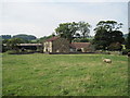
Tang Hall Farm
From the footpath from Boltby to Sutton Bank
Image: © Martin Dawes
Taken: 4 Sep 2009
0.01 miles
2

Tang Hall
Looked at from the footpath and field to the south-east.
Image: © Peter Wood
Taken: 8 Jul 2013
0.01 miles
3
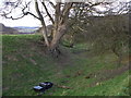
Moat of Ravensthorp Manor
A sycamore has anchored itself to the earthworks of Ravensthorp, a moated manorhouse & associated medieval hamlet It was owned by Lady Eva de Boltby in 1274-1316, as her main residence. It is unknown as to when it was abandoned. The moat looks as though it should have held water, due to some local streams are diverted towards it, and at the SW end a sandstone culvert emerges with trickling water that then runs into a small mill pond.
Boltby Forest an just be made out to the left of the sycamore tree.
Image: © Matthew Hatton
Taken: 9 Mar 2008
0.05 miles
4
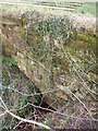
Stream emerging from Sandstone Culvert
A footpath from Tang Hall to Boltby passes over this culvert. It is situated in the SW corner of the moat of Raventhorp Deserted Medieval Village (DMV).
Image: © Matthew Hatton
Taken: 9 Mar 2008
0.05 miles
5
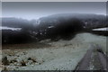
Track heading East from Tang Hall with Weather Closing In
Mist and snow descends over the scene near Tang Hall
Image: © Chris Heaton
Taken: 9 Feb 2018
0.06 miles
6
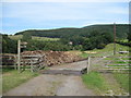
Track from Tang Hall Farm to Greendale Farm
Image: © Martin Dawes
Taken: 4 Sep 2009
0.08 miles
7
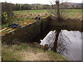
Sluice & Dam Wall
C19th sandstone dam wall, with a small mill pond near to Tang Hall.
Image: © Matthew Hatton
Taken: 9 Mar 2008
0.10 miles
8
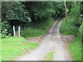
Dry Ford near Ravensthorpe Mill
Looked at from the south-east.
Image: © Peter Wood
Taken: 8 Jul 2013
0.15 miles
9
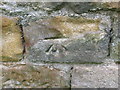
Ordnance Survey Cut Mark
This can be found on the wall of a barn at Ravensthorpe Mill.
For more detail see : http://www.bench-marks.org.uk/bm49733
Image: © Peter Wood
Taken: 8 Jul 2013
0.15 miles