IMAGES TAKEN NEAR TO
Felixkirk, THIRSK, YO7 2DW
Introduction
This page details the photographs taken nearby to YO7 2DW by members of the Geograph project.
The Geograph project started in 2005 with the aim of publishing, organising and preserving representative images for every square kilometre of Great Britain, Ireland and the Isle of Man.

There are currently over 7.5m images from over14,400 individuals and you can help contribute to the project by visiting https://www.geograph.org.uk
Image Map
Images are licensed for reuse under creativecommons.org/licenses/by-sa/2.0
Notes
- Clicking on the map will re-center to the selected point.
- The higher the marker number, the further away the image location is from the centre of the postcode.
Image Listing (7 Images Found)
Images are licensed for reuse under creativecommons.org/licenses/by-sa/2.0
Image
Details
Distance
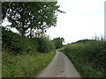
1
Goldhill Lane
This road only serves Kelmire Grange, although it goes to Boltby.
Image: © T Eyre
Taken: 19 Nov 2018
0.07 miles
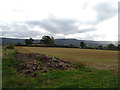
3
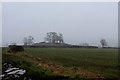
Countryside off High Lane
Looking south east over fields beside High Lane - as snow starts to fall
Image: © Chris Heaton
Taken: 9 Feb 2018
0.21 miles
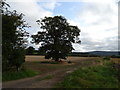
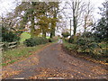
6

High Lane
The road to Felixkirk from Sutton under Whitestonecliffe.
Image: © Richard Webb
Taken: 11 Aug 2016
0.23 miles