
IMAGES TAKEN NEAR TO
Low Lane, THIRSK, YO7 2BZ
Introduction
This page details the photographs taken nearby to Low Lane, YO7 2BZ by members of the Geograph project.
The Geograph project started in 2005 with the aim of publishing, organising and preserving representative images for every square kilometre of Great Britain, Ireland and the Isle of Man.

There are currently over 7.5m images from over14,400 individuals and you can help contribute to the project by visiting https://www.geograph.org.uk
Image Map
Images are licensed for reuse under creativecommons.org/licenses/by-sa/2.0
Notes
- Clicking on the map will re-center to the selected point.
- The higher the marker number, the further away the image location is from the centre of the postcode.
Image Listing (11 Images Found)
Images are licensed for reuse under creativecommons.org/licenses/by-sa/2.0
Image
Details
Distance
1
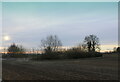
Circle of Trees and Shrubs off Low Lane
Located in a field beside Low Lane, these trees and shrubs form a barrier that conceals a pool of water.
Image: © Chris Heaton
Taken: 30 Dec 2020
0.09 miles

4
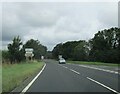
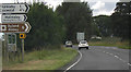
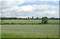
Junction with Low Lane (caravan route) to Helmsley
From the A19 it is marked on the O/S map as Caravan Route avoiding Sutton Bank
Image: © Martin Dawes
Taken: 31 Jul 2021
0.16 miles
7
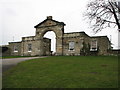
The gate lodge to a holiday homes/caravan park
This is right next to the A19
Image: © Nick W
Taken: 24 Feb 2006
0.20 miles

10

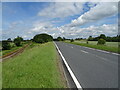
Field path, Thirkleby
Short stretch of public footpath across two fields and linking two roads.
Image: © Gordon Hatton
Taken: 23 May 2010
0.23 miles