
IMAGES TAKEN NEAR TO
Hungerhill Lane, YORK, YO62 7SQ
Introduction
This page details the photographs taken nearby to Hungerhill Lane, YO62 7SQ by members of the Geograph project.
The Geograph project started in 2005 with the aim of publishing, organising and preserving representative images for every square kilometre of Great Britain, Ireland and the Isle of Man.

There are currently over 7.5m images from over14,400 individuals and you can help contribute to the project by visiting https://www.geograph.org.uk
Image Map
Images are licensed for reuse under creativecommons.org/licenses/by-sa/2.0
Notes
- Clicking on the map will re-center to the selected point.
- The higher the marker number, the further away the image location is from the centre of the postcode.
Image Listing (17 Images Found)
Images are licensed for reuse under creativecommons.org/licenses/by-sa/2.0
Image
Details
Distance
1

Hangar at Wombleton
Situated at the northern edge of the old airfield.
Image: © Pauline E
Taken: 12 Jun 2011
0.02 miles

3

Large building at Wombleton Aerodrome
The old WW2 Airfield south of Wombleton still has most of its runways intact after 60 years.
This large building seems to have evolved from the original hangars.
At one time it housed a factory making micro-light aircraft, a planning notice at the gate says an application is in hand to convert it from a 'Potato store' to a factory making wood fuel pellets.
Image: © Colin Grice
Taken: 16 Sep 2007
0.05 miles

5

Cropfield off Hungerhill Lane
View towards the small belt of woodland across the oilseed rape crop interspersed with poppies.
Image: © Pauline E
Taken: 12 Jun 2011
0.10 miles

7

Hungerhill Lane, Wombleton
Beside the former RAF Wombleton Airfield. Towards Nunnington.
Image: © JThomas
Taken: 4 Jul 2020
0.14 miles
8
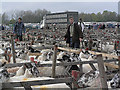
Sheep sale at Wombleton Airfield
Two large Autumn sheep sales (which used to be held at Fadmoor to the NE, see http://www.geograph.org.uk/photo/100376) are now held at this site, taking advantage of unlimited hard standing for vehicles to park and load/unload.
The sheep pens are set up on grass alongside the old concrete runway.
Image: © Colin Grice
Taken: 22 Oct 2009
0.14 miles
9

Sheep sale at Wombleton Airfield
Suffolk Rams (more commonly called Tups in this area) have been preened to look their best on sale day.
A good Ram will make about £500.
Image: © Colin Grice
Taken: 22 Oct 2009
0.15 miles
10

Selling sheep at Wombleton Airfield
In a small podium, the auctioneer from Wells Cundall is using a microphone to take bids on lots of sheep being sold in a temporary ring made up of wooden hurdles.
Approximately 4,000 sheep were sold on 22nd October 2009.
Image: © Colin Grice
Taken: 22 Oct 2009
0.16 miles