
IMAGES TAKEN NEAR TO
Hutton-le-Hole, YORK, YO62 6UH
Introduction
This page details the photographs taken nearby to YO62 6UH by members of the Geograph project.
The Geograph project started in 2005 with the aim of publishing, organising and preserving representative images for every square kilometre of Great Britain, Ireland and the Isle of Man.

There are currently over 7.5m images from over14,400 individuals and you can help contribute to the project by visiting https://www.geograph.org.uk
Image Map
Images are licensed for reuse under creativecommons.org/licenses/by-sa/2.0
Notes
- Clicking on the map will re-center to the selected point.
- The higher the marker number, the further away the image location is from the centre of the postcode.
Image Listing (16 Images Found)
Images are licensed for reuse under creativecommons.org/licenses/by-sa/2.0
Image
Details
Distance
1
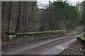
Bridge on road to Lingmoor Farm
The stream here is generally dry due to the porous nature of the Limestone, however it re-emerges a mile or so downstream.
Image: © Colin Grice
Taken: 20 Jan 2006
0.11 miles
2
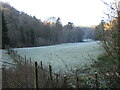
Near Yoadwath
A hard frost in Douthwaite Dale.
Image: © T Eyre
Taken: 11 Dec 2022
0.14 miles
3
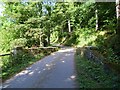
Bridge over Hutton Beck
Stone arch bridge carrying a private road and prow over Hutton Beck, which on the day of the photograph was completely dry. Beyond the bridge the road climbs up past Spring Wood, which is largely conifer planting, though the name would suggest an old coppiced woodland.
Image: © Gordon Hatton
Taken: 20 Sep 2009
0.17 miles
4
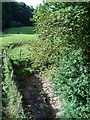
Hutton Beck
Or more correctly, the dried up bed of Hutton Beck. The rivers and becks that drain south from the central moorlands have to find their way through the Tabular Hills, which are largely composed of limestone. Hutton Beck flows strongly through Hutton le Hole, but somewhere south of the village it meets the limestone and disappears underground.
Image: © Gordon Hatton
Taken: 20 Sep 2009
0.18 miles
5
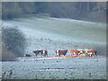
Cattle in the frost
A hard frost in the Hutton Beck valley.
Image: © T Eyre
Taken: 11 Dec 2022
0.19 miles
6
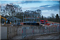
The new Ravenswick Hall
A substantial old villa style house here was in a poor state of repair, and ambitious plans have been passed for a new contemporary stately home.
It is a very large project and a great deal of earth has been moved just to create the site for building work to commence.
Surprisingly Geograph only has this shot of the original house, which is actually a similar viewpoint and direction.
There had been considerable further deterioration since 2007, especially to rear/front away from the road.
https://www.geograph.org.uk/photo/544338
Image: © Colin Grice
Taken: 11 Mar 2018
0.20 miles
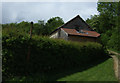
8
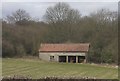
Barn near Halfway House
Across the road from Halfway House is this rather nicely located old barn.
On the road between Kirkbymoorside and Hutton-le-Hole.
Image: © Colin Grice
Taken: 31 Mar 2006
0.21 miles
9
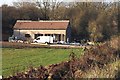
Barn conversion in progress
This barn near Halfway House has been changing rapidly into a Vet's surgery through the Autumn.
A picture of it 18 months previously can be seen here. http://www.geograph.org.uk/photo/144819
Image: © Colin Grice
Taken: 16 Nov 2007
0.21 miles
10
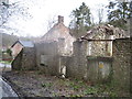
Derelict buildings at Yoadwath
On the side of Young Bank Lane.
Image: © Martin Dawes
Taken: 6 Feb 2013
0.22 miles