
IMAGES TAKEN NEAR TO
West Ville Mews, YORK, YO62 6HW
Introduction
This page details the photographs taken nearby to West Ville Mews, YO62 6HW by members of the Geograph project.
The Geograph project started in 2005 with the aim of publishing, organising and preserving representative images for every square kilometre of Great Britain, Ireland and the Isle of Man.

There are currently over 7.5m images from over14,400 individuals and you can help contribute to the project by visiting https://www.geograph.org.uk
Image Map
Images are licensed for reuse under creativecommons.org/licenses/by-sa/2.0
Notes
- Clicking on the map will re-center to the selected point.
- The higher the marker number, the further away the image location is from the centre of the postcode.
Image Listing (240 Images Found)
Images are licensed for reuse under creativecommons.org/licenses/by-sa/2.0
Image
Details
Distance
1
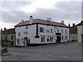
The White Horse, West End, Kirkbymoorside
This inn stands on the corner of West End and Piercy End, at the bottom of Market Place
Image: © John Martin
Taken: 11 Mar 2007
0.01 miles
2
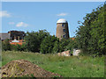
Grade II listed Windmill tower, Kirkbymoorside
At the time this picture was taken, the windmill is up for sale. It was built in 1839 as recorded on the datestone, but a dispute with a neighbour meant its sails were never hung. It did serve as a corn mill for a short time using an oil-fuelled engine.
The circular tower is built from red brick in English garden
wall bond with a slate roof. The structure tapers from 6 metres to
3.4 metres and has 5 storeys, with 2 windows to each floor.
This view is from the footpath between Piercy End and Wainds Field.
Image: © Pauline E
Taken: 3 Jul 2011
0.03 miles
3

Methodist Chapel, No 26, West End (1)
The former Methodist chapel shows a build date of 1861. The building has many fine features architecturally, but is not included in English Heritage's listed buildings.
The chapel has now been converted into apartments.
Image: © Mike Kirby
Taken: 9 Jul 2011
0.03 miles
4
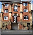
Methodist Chapel, No 26, West End (2)
The building has many fine features architecturally, but is not included in English Heritage's listed buildings.
Image: © Mike Kirby
Taken: 9 Jul 2011
0.03 miles
5
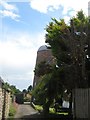
Windmill at rear of No 17, West End
A grade II listed building of 5-storeys with 2 windows to each floor, showing 1839 on date stone. Built in red brick, with a pitched replacement roof. See Image
LBS No: 328430
Image: © Mike Kirby
Taken: 9 Jul 2011
0.03 miles
6

View of Windmill Tower from Wainds Field
The windmill, built in 1839, sits to the south of West End. Its sails were never added to the tower.
Image: © Pauline E
Taken: 3 Apr 2011
0.03 miles
7
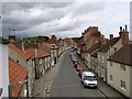
Elevated view of West End.
Kirkby had another public house, the Cricketers, until 2002. The owners
converted the pub into a residence and it is now simply number 80. The
scaffolding provided a fine vantage point.
Image: © Martin Smith
Taken: 21 May 2003
0.03 miles
8
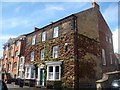
No 22, West End, The Georgian House
The Georgian House and attached railings to front form a grade II listed 3-storey house dated mid C18. Dressed sandstone to front with raised quoins and raised first and second floor bands, coursed rubble and brick gable wall to right. Moulded eaves cornice to slate roof and brick end stacks. Central door in pedimented, pilastered door case. At end right of first floor is a circular sundial which can just be made out in the ivy.
LBS No: 328428
Image: © Mike Kirby
Taken: 9 Jul 2011
0.03 miles
9
View over Kirkbymoorside rooftops
From the old railway bridge in Ings Lane, there is a good view towards the Windmill Tower in West End. It was used to grind corn for a short while but was never wind-powered.
Image: © Pauline E
Taken: 3 Apr 2011
0.03 miles
10
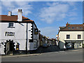
West End from Market Place
This narrow street, with one side parking, has double decker buses running in both directions.
Image: © Pauline E
Taken: 3 Apr 2011
0.04 miles