
IMAGES TAKEN NEAR TO
Malton Road, YORK, YO62 4LD
Introduction
This page details the photographs taken nearby to Malton Road, YO62 4LD by members of the Geograph project.
The Geograph project started in 2005 with the aim of publishing, organising and preserving representative images for every square kilometre of Great Britain, Ireland and the Isle of Man.

There are currently over 7.5m images from over14,400 individuals and you can help contribute to the project by visiting https://www.geograph.org.uk
Image Map
Images are licensed for reuse under creativecommons.org/licenses/by-sa/2.0
Notes
- Clicking on the map will re-center to the selected point.
- The higher the marker number, the further away the image location is from the centre of the postcode.
Image Listing (130 Images Found)
Images are licensed for reuse under creativecommons.org/licenses/by-sa/2.0
Image
Details
Distance
1

Bungalow and fingerpost on the B1257, Hovingham
Image: © JThomas
Taken: 16 May 2020
0.01 miles
2

Direction Sign – Signpost beside the B1257 in Hovingham
Located on the north side of the B1257 opposite Potticar Bank, Hovingham parish. 3 arms, 1 missing, and annulus finial. An arm B1257; MALTON 8 has been lost since this photo https://www.geograph.org.uk/photo/6711762.
Milestone Society National ID: YN_SE6675A
Image: © C Minto
Taken: 16 Oct 2023
0.01 miles
3
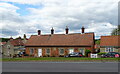
Almshouses on the B1257, Hovingham
Dated 1870.
Image: © JThomas
Taken: 16 May 2020
0.01 miles
4
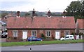
Almshouses in Hovingham
These almshouses stand by the main road at the south end of the village, and are unusual in that they are constructed in brick, whereas most of the village houses are of limestone. A tablet on the front is inscribed 'Let thy widows trust in me - 1870'
Image: © Gordon Hatton
Taken: 1 Oct 2012
0.02 miles
6
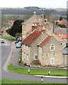
A view of Hovingham
The south end of the main street with a huddle of traditional stone buildings. The larger building towards the rear is the Worsley Arms Hotel.
Image: © Gordon Hatton
Taken: 15 Jan 2019
0.03 miles
7
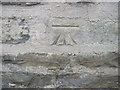
Ordnance Survey Cut Mark
This mark can be found on the wall of a cottage in High Street.
For more details see : http://www.bench-marks.org.uk/bm42128
Image: © Peter Wood
Taken: 21 Mar 2012
0.03 miles

9
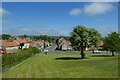
Looking down on High Street
Looking through the village of Hovingham.
Image: © DS Pugh
Taken: 30 May 2021
0.04 miles
10
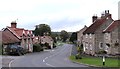
High Street, Hovingham
The main road through Hovingham, looking north towards the village centre.
Image: © Gordon Hatton
Taken: 1 Oct 2012
0.04 miles