IMAGES TAKEN NEAR TO
YO62 4EH
Introduction
This page details the photographs taken nearby to YO62 4EH by members of the Geograph project.
The Geograph project started in 2005 with the aim of publishing, organising and preserving representative images for every square kilometre of Great Britain, Ireland and the Isle of Man.

There are currently over 7.5m images from over14,400 individuals and you can help contribute to the project by visiting https://www.geograph.org.uk
Image Map
Images are licensed for reuse under creativecommons.org/licenses/by-sa/2.0
Notes
- Clicking on the map will re-center to the selected point.
- The higher the marker number, the further away the image location is from the centre of the postcode.
Image Listing (13 Images Found)
Images are licensed for reuse under creativecommons.org/licenses/by-sa/2.0
Image
Details
Distance
1
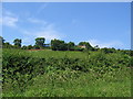
Saw Mill
Taken from carr Lane, between Wass and Ampleforth. Typical view of this area. The long red roof on the left of the hillside is indicated on the map as a sawmill.
Image: © Stephen Horncastle
Taken: 9 Jul 2005
0.04 miles
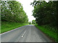
3
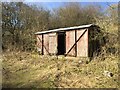
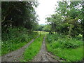
Old Railway Goods Van
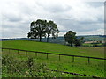
On Westwood Lane near Ampleforth
Image: © Andrew Abbott
Taken: 24 Feb 2018
0.12 miles
6
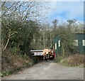
Ampleforth saw mill
The entrance to the saw mill off Westwood Lane. The mill is well concealed and isn't visible at all from Carr Lane down the hillside.
Image: © Gordon Hatton
Taken: 27 Mar 2021
0.13 miles
7
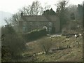
Snake Villa - house on the road to High Woods
There is a working sawmill attached to this but you can only see a couple of tree trunks here.
Image: © Colin Grice
Taken: 25 Mar 2007
0.15 miles
8

Near Ampleforth
Looking south from the road.
Image: © T Eyre
Taken: 21 Jul 2017
0.15 miles
9
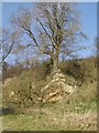
Long disused small quarry
By the minor road from Ampleforth to Hambleton.
Image: © Colin Grice
Taken: 25 Mar 2007
0.16 miles