
IMAGES TAKEN NEAR TO
West End, YORK, YO62 4ED
Introduction
This page details the photographs taken nearby to West End, YO62 4ED by members of the Geograph project.
The Geograph project started in 2005 with the aim of publishing, organising and preserving representative images for every square kilometre of Great Britain, Ireland and the Isle of Man.

There are currently over 7.5m images from over14,400 individuals and you can help contribute to the project by visiting https://www.geograph.org.uk
Image Map
Images are licensed for reuse under creativecommons.org/licenses/by-sa/2.0
Notes
- Clicking on the map will re-center to the selected point.
- The higher the marker number, the further away the image location is from the centre of the postcode.
Image Listing (14 Images Found)
Images are licensed for reuse under creativecommons.org/licenses/by-sa/2.0
Image
Details
Distance
1
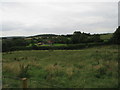
Near Carr House
Looking SW from the footpath.
Image: © T Eyre
Taken: 21 Jul 2017
0.13 miles
3
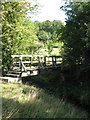
Footbridge over Burtis Beck.
Timber bridge crossing the swift flowing Burtis Beck which drops down the steep southern flank of the Hambleton Hills and is the main feeder for Holbeck.
Image: © Gordon Hatton
Taken: 11 Sep 2007
0.14 miles
4
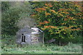
Abandoned Camping Hut near Wass, North Yorkshire
Photographed at about 1.30 p.m. on 2 November 2005
Image: © Uncredited
Taken: 2 Nov 2005
0.15 miles
5
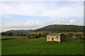
Newstead Barn, near Wass (North Yorkshire)
Photographed on 2 November 2005 at about 2.00 p.m.
Image: © Uncredited
Taken: 2 Nov 2005
0.17 miles
6
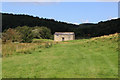
Newstead
Isolated barn, unusual for this area as it supports a slate roof, rather than pantiles.
Image: © Chris Heaton
Taken: 17 Aug 2019
0.17 miles
8
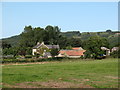
Wass Grange
Farm on the edge of the NYM National Park. The farm might once have been the site of a grange belonging to Byland Abbey.
Image: © Gordon Hatton
Taken: 11 Sep 2007
0.21 miles
9
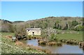
Pond at Newstead
Pond with Canada Geese [left]. I wondered why this is shown as Newstead on the OS map when there is nothing to see other than the pond and a stone barn. The first edition maps of circa 1860 show a complex of buildings beyond the barn, but these disappear from later maps just leaving the name.
Image: © Gordon Hatton
Taken: 20 Apr 2020
0.22 miles
10
Footpath to Wass Grange
The barn at newstead stands out on the hilltop
Image: © Martin Dawes
Taken: 12 Apr 2012
0.22 miles