IMAGES TAKEN NEAR TO
Oulston, YORK, YO61 3RG
Introduction
This page details the photographs taken nearby to YO61 3RG by members of the Geograph project.
The Geograph project started in 2005 with the aim of publishing, organising and preserving representative images for every square kilometre of Great Britain, Ireland and the Isle of Man.

There are currently over 7.5m images from over14,400 individuals and you can help contribute to the project by visiting https://www.geograph.org.uk
Image Map
Images are licensed for reuse under creativecommons.org/licenses/by-sa/2.0
Notes
- Clicking on the map will re-center to the selected point.
- The higher the marker number, the further away the image location is from the centre of the postcode.
Image Listing (11 Images Found)
Images are licensed for reuse under creativecommons.org/licenses/by-sa/2.0
Image
Details
Distance
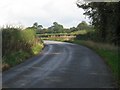
4
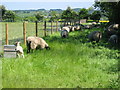
Sheep
A typical view of this grid square looking east.
Image: © Stephen Horncastle
Taken: 3 Jun 2006
0.19 miles
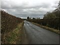
7
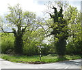
High Hedges Limit Options
For Geographers. The road to Oak Trees from Easingwold, North-East of Beggar's Bed.
Image: © Roger Gilbertson
Taken: 20 Oct 2006
0.21 miles
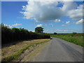
8
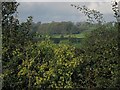
Hedgerow And Wood
A view from the road near Oak Trees.
Image: © Roger Gilbertson
Taken: 20 Oct 2006
0.21 miles
9
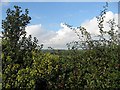
Touching The Sky
The landscape appears to support the clouds.
Image: © Roger Gilbertson
Taken: 20 Oct 2006
0.21 miles
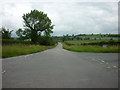
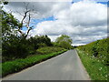
10
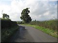
Going Up To Easingwold
From Oulston.
Image: © Roger Gilbertson
Taken: 20 Oct 2006
0.21 miles