
IMAGES TAKEN NEAR TO
Alne Road, YORK, YO61 3JZ
Introduction
This page details the photographs taken nearby to Alne Road, YO61 3JZ by members of the Geograph project.
The Geograph project started in 2005 with the aim of publishing, organising and preserving representative images for every square kilometre of Great Britain, Ireland and the Isle of Man.

There are currently over 7.5m images from over14,400 individuals and you can help contribute to the project by visiting https://www.geograph.org.uk
Image Map
Images are licensed for reuse under creativecommons.org/licenses/by-sa/2.0
Notes
- Clicking on the map will re-center to the selected point.
- The higher the marker number, the further away the image location is from the centre of the postcode.
Image Listing (10 Images Found)
Images are licensed for reuse under creativecommons.org/licenses/by-sa/2.0
Image
Details
Distance
1
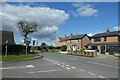
Raskelf Road
Looking along Raskelf Road in Easingwold from the junction with Alne Road.
Image: © DS Pugh
Taken: 3 Apr 2022
0.05 miles
2
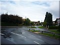
Easingwold from Alne Road
The west side of Easingwold seen from Alne Road. To the left is the road to Raskelf.
Image: © DS Pugh
Taken: 28 Aug 2010
0.06 miles
3
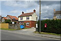
House on Raskelf Road, Easingwold
Showing position of Postbox No. YO61 445.
See Image] for postbox.
Image: © JThomas
Taken: 16 May 2020
0.11 miles
4
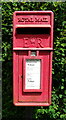
Elizabeth II postbox on Raskelf Road, Easingwold
Image: © JThomas
Taken: 16 May 2020
0.12 miles
6
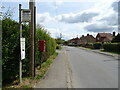
Bus stop on Raskelf Road, Easingwold
Showing position of Postbox No. YO61 445.
See Image] for postbox.
Image: © JThomas
Taken: 16 May 2020
0.13 miles
7
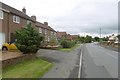
Raskelf Road, Easingwold
Leaving Easingwold to the west, I missed the town centre, having followed the Sustrans route through Millfields.
Image: © Richard Webb
Taken: 11 Aug 2016
0.13 miles
8
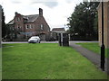
Easingwold railway station (site), Yorkshire
Opened in 1891 by the Easingwold Railway as a short branch off the East Coast main line at Alne, this station closed to passengers in 1948 and completely in 1957.
View south towards Alne. The single platform was in front of the former Railway Hotel, with the buffers behind and to the left of the camera position, and the line to Alne running to the right where the trees now are. No trace remains.
Image: © Nigel Thompson
Taken: 25 Aug 2015
0.20 miles
9

Site of former Easingwold station, 1991
View westward, towards Alne: terminus of the independent Easingwold Railway from Alne, on the ex-NER East Coast Main Line. The line was closed to passengers 29/11/48, to goods 30/12/57; by 1991 the only identification was the street name.
Image: © Ben Brooksbank
Taken: 7 Sep 1991
0.23 miles
10

One-coach train from Alne at Easingwold, 1946
The buffers are off frame to the left. This was the terminus of the independent Easingwold Light Railway from Alne, which survived until 29/11/48 for passengers, 30/12/57 for goods. The locomotive is No.2, built Hudswell-Clarke 1903, rebuilt 1924, withdrawn 1947.
Image: © Walter Dendy, deceased
Taken: 12 Aug 1946
0.25 miles