IMAGES TAKEN NEAR TO
Thornhill Wind, YORK, YO61 1RL
Introduction
This page details the photographs taken nearby to Thornhill Wind, YO61 1RL by members of the Geograph project.
The Geograph project started in 2005 with the aim of publishing, organising and preserving representative images for every square kilometre of Great Britain, Ireland and the Isle of Man.

There are currently over 7.5m images from over14,400 individuals and you can help contribute to the project by visiting https://www.geograph.org.uk
Image Map (Loading...)


Getting Data...Please wait
Leaflet Map data © OpenStreetMap
Images are licensed for reuse under creativecommons.org/licenses/by-sa/2.0
Notes
- Clicking on the map will re-center to the selected point.
- The higher the marker number, the further away the image location is from the centre of the postcode.
Image Listing (21 Images Found)
Images are licensed for reuse under creativecommons.org/licenses/by-sa/2.0
Image
Details
Distance
1
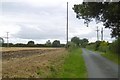
Towards Alne
Looking alongside Main Street over farmland to houses in Alne.
Image: © DS Pugh
Taken: 28 Aug 2010
0.06 miles
2

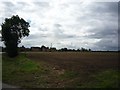
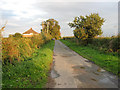
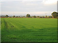
Stubble, Alne
Not long before a new crop is planted here.
Image: © Richard Webb
Taken: 11 Aug 2016
0.09 miles
4
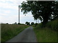
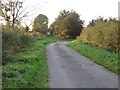
Snowfield Lane
Snowfield Lane on the outskirts of Alne.
Image: © DS Pugh
Taken: 28 Aug 2010
0.11 miles
6
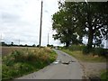
Snowfield Lane
Farm access road near Alne.
Image: © Richard Webb
Taken: 11 Aug 2016
0.12 miles
7
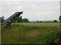
Leaving Snowfield Farm
Towards Tollerton.
Image: © Roger Gilbertson
Taken: 20 Oct 2006
0.12 miles
8
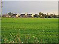
More New Houses
Encroaching on the farmland at the Northern end of Alne.
Image: © Roger Gilbertson
Taken: 20 Oct 2006
0.12 miles
9
The Road To Snowfield Farm
North of Alne.
Image: © Roger Gilbertson
Taken: 20 Oct 2006
0.12 miles
10
Towards The Howardian Hills
From South of Snowfield Farm.
Image: © Roger Gilbertson
Taken: 20 Oct 2006
0.12 miles