IMAGES TAKEN NEAR TO
Easingwold Road, YORK, YO61 1LR
Introduction
This page details the photographs taken nearby to Easingwold Road, YO61 1LR by members of the Geograph project.
The Geograph project started in 2005 with the aim of publishing, organising and preserving representative images for every square kilometre of Great Britain, Ireland and the Isle of Man.

There are currently over 7.5m images from over14,400 individuals and you can help contribute to the project by visiting https://www.geograph.org.uk
Image Map
Images are licensed for reuse under creativecommons.org/licenses/by-sa/2.0
Notes
- Clicking on the map will re-center to the selected point.
- The higher the marker number, the further away the image location is from the centre of the postcode.
Image Listing (13 Images Found)
Images are licensed for reuse under creativecommons.org/licenses/by-sa/2.0
Image
Details
Distance
1
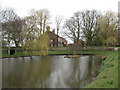
Townend pond, Stillington
Situated at the west end of the village, and probably once used for watering cattle etc.
Image: © Gordon Hatton
Taken: 12 Mar 2007
0.09 miles
2
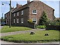
Cottage Farm at Stillington
Cottage Farm is at the western end of the village of Stillington; it has OS flush bracket number 2354 on its front wall.
Image: © Trevor Littlewood
Taken: 13 Jun 2004
0.17 miles
3
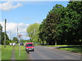
Main Street, Stillington
Looking westward.
Image: © Peter Wood
Taken: 10 Jun 2014
0.17 miles
4
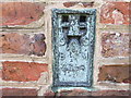
Ordnance Survey Flush Bracket 2354
This can be found on the wall of what once was a building at Cottage Farm - now a private dwelling.
For more detail see : http://www.bench-marks.org.uk/bm9977
Image: © Peter Wood
Taken: 10 Jun 2014
0.17 miles
7
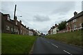
High Street, Stillington
Looking along High Street on the west side of the village.
Image: © DS Pugh
Taken: 15 Aug 2021
0.23 miles
8
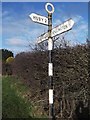
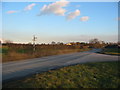
Direction Sign ? Signpost
Located on the north side of the junction of West lane and Wandell Balk in Stillington parish. 3 arms and annulus finial. See also https://www.geograph.org.uk/photo/5916996.
Milestone Society National ID: YN_SE5768
Image: © C Minto
Taken: 27 Jan 2019
0.23 miles
9
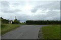
Junction with West Lane
Looking along the end of Wandell Balk.
Image: © DS Pugh
Taken: 15 Aug 2021
0.24 miles