
IMAGES TAKEN NEAR TO
Fothergill Way, YORK, YO51 9UX
Introduction
This page details the photographs taken nearby to Fothergill Way, YO51 9UX by members of the Geograph project.
The Geograph project started in 2005 with the aim of publishing, organising and preserving representative images for every square kilometre of Great Britain, Ireland and the Isle of Man.

There are currently over 7.5m images from over14,400 individuals and you can help contribute to the project by visiting https://www.geograph.org.uk
Image Map
Images are licensed for reuse under creativecommons.org/licenses/by-sa/2.0
Notes
- Clicking on the map will re-center to the selected point.
- The higher the marker number, the further away the image location is from the centre of the postcode.
Image Listing (16 Images Found)
Images are licensed for reuse under creativecommons.org/licenses/by-sa/2.0
Image
Details
Distance
1

Boroughbridge, Horsefair
This is an area of new housing on the west side of Horsefair in Boroughbridge. According to the OS benchmark database there was a cutmark in this vicinity on the previous building, which is described as a "depot". The mark has been destroyed.
Image: © Mel Towler
Taken: 13 Mar 2022
0.12 miles
2

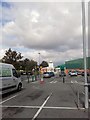
Morrisons Supermarket, Boroughbridge
This large supermarket and filling station stand at the southern end of Boroughbridge. The supermarket was once known as 'Carrefour'.
Image: © Gordon Hatton
Taken: 10 Dec 2007
0.16 miles

4
![A1 [M] at Boroughbridge](https://s2.geograph.org.uk/photos/63/27/632706_d42b0074_120x120.jpg)
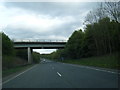
A1 [M] at Boroughbridge
Looking north along the motorway near where it passes Boroughbridge.
Image: © Gordon Hatton
Taken: 10 Dec 2007
0.17 miles
5

Covered walk, Morrisons, Boroughbridge
Image: © Jonathan Thacker
Taken: 22 Aug 2025
0.18 miles
8
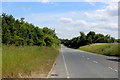
A168 outside Boroughbridge
The Great North Road or A1 has moved westward in various stages around the town of Boroughbridge.
Originally it passed straight through the centre of the town. It was then shifted west, and this road formed one carriageway taking it away from the town. The A1 was moved again, running parallel and side by side to this one and upgraded to a motorway. The photographed road being renumbered as the A168.
Image: © Chris Heaton
Taken: 29 Jun 2015
0.19 miles
9
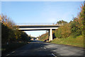
A168 passing under bridge by Boroughbridge
Image: © Peter Bond
Taken: 10 Nov 2013
0.19 miles
10
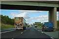
A1(M) under the bridge near Boroughbridge
The road across the top is shy about its name.
Image: © Robin Webster
Taken: 7 Oct 2011
0.19 miles