
IMAGES TAKEN NEAR TO
Roecliffe, YORK, YO51 9NE
Introduction
This page details the photographs taken nearby to YO51 9NE by members of the Geograph project.
The Geograph project started in 2005 with the aim of publishing, organising and preserving representative images for every square kilometre of Great Britain, Ireland and the Isle of Man.

There are currently over 7.5m images from over14,400 individuals and you can help contribute to the project by visiting https://www.geograph.org.uk
Image Map
Images are licensed for reuse under creativecommons.org/licenses/by-sa/2.0
Notes
- Clicking on the map will re-center to the selected point.
- The higher the marker number, the further away the image location is from the centre of the postcode.
Image Listing (10 Images Found)
Images are licensed for reuse under creativecommons.org/licenses/by-sa/2.0
Image
Details
Distance

3

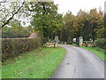
Path around Waingates Farm
Footpath 15 113/8/2 approaches a right-angled right ben as it works its way around the farm's protective belt of trees. Taken in the midst of the short sharp shower expected in Image]; at least there's a rainbow.
Image: © Derek Harper
Taken: 22 Dec 2016
0.06 miles
4
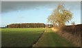
Path to Waingates Farm
Footpath 15 113/8/2 follows the field edge and then turns left along the belt of trees around the farm. There's about to be a short sharp shower.
Image: © Derek Harper
Taken: 22 Dec 2016
0.08 miles
5

Waingates Lane
The driveway leading away from the farm is followed by footpath 15 113/8/2. At the bend, footpath 15 113/10/2 branches off to the right.
Image: © Derek Harper
Taken: 22 Dec 2016
0.10 miles
6

Footpath to Roecliffe
Footpath 15 113/10/2 heads towards a fiery rainbow from Waingates Lane after the sun shown in Image] has vanished.
Image: © Derek Harper
Taken: 22 Dec 2016
0.12 miles
7

Far Thorns Plantation
From the same place as Image], looking left.
Image: © Derek Harper
Taken: 22 Dec 2016
0.15 miles
8

Waingates Lane
Footpath 15 113/8/3 follows this lane, the exit road from Waingates Farm, through the area called Byergates Field. I don't think the stile on the left indicates a right of way.
Image: © Derek Harper
Taken: 22 Dec 2016
0.17 miles
9
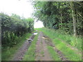
Path along woodland edge.
South of Waingates farm.
Image: © steven ruffles
Taken: 29 Jun 2019
0.18 miles
10
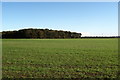
Far Thorns Plantation
Southern portion of this stretch of woodland. The photograph was taken from the Roecliffe Business Centre, although my map marks the establishment as Waingates Farm
Image: © Chris Heaton
Taken: 1 Nov 2006
0.19 miles