IMAGES TAKEN NEAR TO
Aldborough, Boroughbridge, YORK, YO51 9HB
Introduction
This page details the photographs taken nearby to YO51 9HB by members of the Geograph project.
The Geograph project started in 2005 with the aim of publishing, organising and preserving representative images for every square kilometre of Great Britain, Ireland and the Isle of Man.

There are currently over 7.5m images from over14,400 individuals and you can help contribute to the project by visiting https://www.geograph.org.uk
Image Map
Images are licensed for reuse under creativecommons.org/licenses/by-sa/2.0
Notes
- Clicking on the map will re-center to the selected point.
- The higher the marker number, the further away the image location is from the centre of the postcode.
Image Listing (8 Images Found)
Images are licensed for reuse under creativecommons.org/licenses/by-sa/2.0
Image
Details
Distance
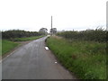
1

Brickfield House
On the road from Boroughbridge to Lower Dunsforth.
Image: © Oliver Dixon
Taken: 16 Nov 2018
0.01 miles

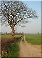
4
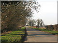
'Roman Road' near Aldborough
This quiet country lane follows the line of the Roman Road linking Eboracum [York] with Isurium Brigantum [Aldborough].
Image: © Gordon Hatton
Taken: 4 Feb 2007
0.13 miles
5
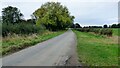
Roman road leading to Aldborough
Holbecks Lane following the line of the earlier Roman road.
Image: © Sandy Gerrard
Taken: 17 Oct 2021
0.16 miles
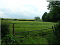
6
Farm track
Along the Boroughbridge - Lower Dunsforth road.
Image: © DS Pugh
Taken: 28 Mar 2007
0.20 miles