
IMAGES TAKEN NEAR TO
Larks Road, YORK, YO51 9GS
Introduction
This page details the photographs taken nearby to Larks Road, YO51 9GS by members of the Geograph project.
The Geograph project started in 2005 with the aim of publishing, organising and preserving representative images for every square kilometre of Great Britain, Ireland and the Isle of Man.

There are currently over 7.5m images from over14,400 individuals and you can help contribute to the project by visiting https://www.geograph.org.uk
Image Map
Images are licensed for reuse under creativecommons.org/licenses/by-sa/2.0
Notes
- Clicking on the map will re-center to the selected point.
- The higher the marker number, the further away the image location is from the centre of the postcode.
Image Listing (35 Images Found)
Images are licensed for reuse under creativecommons.org/licenses/by-sa/2.0
Image
Details
Distance
1

Boroughbridge 1st railway station (site), Yorkshire
Opened in 1847 by the North eastern railway as the terminus of its line from Pilmoor, this station closed to passengers in 1875 when the line was extended through to Knaresborough, although it continued in use as a goods station until closure of the line in 1964. A replacement passenger station was opened at Kirby Hill, about 300m to the west.
View east at the former station forecourt, which is now within an industrial estate.
Image: © Nigel Thompson
Taken: 21 Sep 2008
0.13 miles
2

Milby Cut
The photograph was taken from the end of a set of Image located to the east of a roundabout that bridges the Milby Cut in Boroughbridge.
Fencing in the trees on the right shows the route of a Image running along the side of the canal to Milby Lock.
Image: © Alan Walker
Taken: 10 Apr 2017
0.17 miles
3
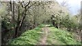
Public footpath
The public footpath in this photograph is running along the old towing path on the southern edge of the Image and is looking eastward, in the direction of Milby Lock.
For another photograph of the footpath taken some 200m ahead, click here:- Image
Image: © Alan Walker
Taken: 10 Apr 2017
0.17 miles
4
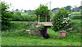
Rail Bridge at Milby
On the route of the long dismantled Knaresborough Boroughbridge & Pilmoor branch line
Image: © David Rogers
Taken: 9 May 2009
0.18 miles
6

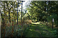
The Ure in flood at Boroughbridge
Boroughbridge is always vulnerable to winter flooding of the River Ure, which can rise rapidly after heavy rain over the dales.
Image: © Gordon Hatton
Taken: Unknown
0.19 miles
7

Weeping Willow on the island
The path from Milby to Boroughbridge runs along the island formed between the River Ure and the Canal which bypasses the Weir. The willow tree completely overhangs the path.
Image: © Oliver Dixon
Taken: 25 Aug 2019
0.20 miles
9
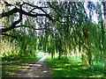
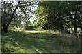
Weeping Willow on the path
The path from Milby to Boroughbridge runs along the island formed between the River Ure and the Canal which bypasses the Weir. The willow tree completely overhangs the path forming a dark "room"..
Image: © Oliver Dixon
Taken: 25 Aug 2019
0.22 miles
10
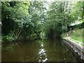
Milby Cut, River Ure, looking east
Part of the navigable waterway from York to Ripon. Milby Lock and Milby Cut were completed in 1769.
Image: © Christine Johnstone
Taken: 9 Aug 2018
0.22 miles