
IMAGES TAKEN NEAR TO
Greenholme Close, YORK, YO51 9GA
Introduction
This page details the photographs taken nearby to Greenholme Close, YO51 9GA by members of the Geograph project.
The Geograph project started in 2005 with the aim of publishing, organising and preserving representative images for every square kilometre of Great Britain, Ireland and the Isle of Man.

There are currently over 7.5m images from over14,400 individuals and you can help contribute to the project by visiting https://www.geograph.org.uk
Image Map
Images are licensed for reuse under creativecommons.org/licenses/by-sa/2.0
Notes
- Clicking on the map will re-center to the selected point.
- The higher the marker number, the further away the image location is from the centre of the postcode.
Image Listing (30 Images Found)
Images are licensed for reuse under creativecommons.org/licenses/by-sa/2.0
Image
Details
Distance
1
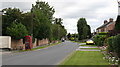
Skelton Road, Langthorpe
The main street of this mainly residential village on the banks of the Ure.
Image: © Gordon Hatton
Taken: 31 Aug 2007
0.10 miles
2
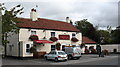
The Fox and Hounds at Langthorpe
Pleasant pub in a quiet village just across the river from Boroughbridge.
Image: © Gordon Hatton
Taken: 31 Aug 2007
0.12 miles
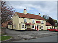
4
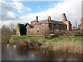
The old brewery at Langthorpe
Standing on the north bank of the Ure, the old brewery has recently been renovated for residential use.
Image: © Gordon Hatton
Taken: 20 Mar 2007
0.14 miles
5
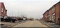
New housing, Milby
A large housing development on the northern side of Boroughbridge, extending from the B6265 across to the Milby road. This area is within the parish of Milby, but might be considered to be in Boroughbridge, Langthorpe or even Kirby Hill.
Image: © Gordon Hatton
Taken: 14 Jan 2018
0.15 miles
6
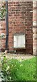
Boroughbridge, 1 Station View
Can I see part of an OS Datum line to the left of the key slot of the white meter box? The full benchmark on this wall has been lost to the installation of the meter box.
Image: © Mel Towler
Taken: 13 Mar 2022
0.15 miles
7

Warwick's Anchor Brewery.
This traditional brewery complex has managed to preserve its identity to a substantial degree, although brewing ceased some time ago. Most of the buildings are listed Grade II.
There has been some tidying up of the buildings since Gordon Hatton's 2007 view http://www.geograph.org.uk/photo/372059.
Image: © Alan Murray-Rust
Taken: 5 Nov 2009
0.16 miles
8

Too cold for a swim
The unusual sight of the River Ure completely iced over in early December 2010. This was the result of two weeks or more of sub zero temperatures including a record low for Yorkshire of -19C at nearby Topcliffe.
Image: © Gordon Hatton
Taken: 8 Dec 2010
0.16 miles
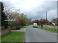
10
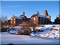
The former brewery, Langthorpe
The former Warwick's Anchor Brewery at Langthorpe. There have been changes to the structure of the buildings since my 2007 photo, with the removal of some items to allow a view over the river.
Image: © Gordon Hatton
Taken: 8 Dec 2010
0.17 miles