
IMAGES TAKEN NEAR TO
Dunsforth Road, YORK, YO51 9EY
Introduction
This page details the photographs taken nearby to Dunsforth Road, YO51 9EY by members of the Geograph project.
The Geograph project started in 2005 with the aim of publishing, organising and preserving representative images for every square kilometre of Great Britain, Ireland and the Isle of Man.

There are currently over 7.5m images from over14,400 individuals and you can help contribute to the project by visiting https://www.geograph.org.uk
Image Map
Images are licensed for reuse under creativecommons.org/licenses/by-sa/2.0
Notes
- Clicking on the map will re-center to the selected point.
- The higher the marker number, the further away the image location is from the centre of the postcode.
Image Listing (123 Images Found)
Images are licensed for reuse under creativecommons.org/licenses/by-sa/2.0
Image
Details
Distance
1

Old Castle House, Aldborough
An attractive house adjacent to the green, with a crenelated porch and wall
Image: © Paul Buckingham
Taken: 1 May 2011
0.07 miles
2
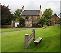
Old Castle House
View from the stocks on the village green.
Image: © David Rogers
Taken: 17 Aug 2010
0.07 miles
3
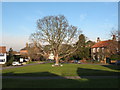
Village Green Aldborough
Aldborough is a pleasant village with a large green surrounded by a mixture of historic properties.
Image: © Gordon Hatton
Taken: 4 Feb 2007
0.08 miles
4
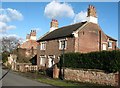
Houses in Aldborough
A handsome brick house with nice stone mouldings around the windows etc. The house beyond is similar in style.
Image: © Gordon Hatton
Taken: 6 Feb 2008
0.08 miles
5

Aldborough to Lower Dunsforth road side gatepost
A damaged and half hidden benchmark on the lowest levels of the old stone gatepost, now with a plethora of ivy around it. The pavement has partially obscured the mark.
Image: © Mel Towler
Taken: 6 Jun 2021
0.09 miles
6

Aldborough to Lower Dunsforth road side gatepost
Wider angle of the location of a damaged and half hidden benchmark on the lowest levels of the old stone gatepost, now with a plethora of ivy around it. The pavement has partially obscured the mark.
Image: © Mel Towler
Taken: 6 Jun 2021
0.09 miles
7

Former Vicarage, Aldborough
Seen from near the church porch, it naturally has its own gate into the churchyard. As the church is now part of a large united parish, this is doubtless no longer the residence of the incumbent.
Image: © Alan Murray-Rust
Taken: 8 Feb 2010
0.09 miles
8

The village green, Aldborough
The old stocks and now sheltered from the sun by a tree - I doubt the miscreants were afforded that luxury when the stocks were in active use.
Image: © Elliott Simpson
Taken: 6 Aug 2002
0.09 miles
9
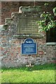
Aldborough Court House Steps.
The stone plaque reads "The Old Court House of the Ancient Borough of Aldborough and Boroughbridge at which the members of Parliament were elected until 1832"
The blue plaque commemorates the crew of a Canadian Airforce Lancaster Bomber - unfortunately the photo is not sharp enough to read the details, but I think it was from 425 Squadron - see http://www.airforce.forces.gc.ca/3wing/squadron/425_e.asp
Image: © Elliott Simpson
Taken: 6 Aug 2002
0.10 miles
10
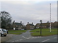
The Square, Aldborough
The crossing of roads in the middle of the green is clearly visible in this view. Straight ahead is Back Street.
Image: © Alan Murray-Rust
Taken: 8 Feb 2010
0.10 miles