
IMAGES TAKEN NEAR TO
All Saints Close, YORK, YO51 9DW
Introduction
This page details the photographs taken nearby to All Saints Close, YO51 9DW by members of the Geograph project.
The Geograph project started in 2005 with the aim of publishing, organising and preserving representative images for every square kilometre of Great Britain, Ireland and the Isle of Man.

There are currently over 7.5m images from over14,400 individuals and you can help contribute to the project by visiting https://www.geograph.org.uk
Image Map
Images are licensed for reuse under creativecommons.org/licenses/by-sa/2.0
Notes
- Clicking on the map will re-center to the selected point.
- The higher the marker number, the further away the image location is from the centre of the postcode.
Image Listing (46 Images Found)
Images are licensed for reuse under creativecommons.org/licenses/by-sa/2.0
Image
Details
Distance
1
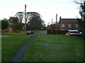
Kirby Hill, the Green
Looking east along Church Lane
Image: © Alan Murray-Rust
Taken: 5 Nov 2009
0.07 miles
2
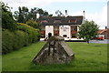
Village Well
Sealed Well in the village of Kirby Hill with the Bluebell Inn beyond.
Image: © David Rogers
Taken: 25 Jun 2008
0.08 miles
3

War Memorial at Kirby Hill
On a grassed area before the old school
Image: © Martin Dawes
Taken: 8 Sep 2017
0.08 miles
6

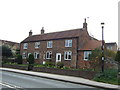
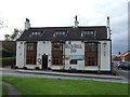
Milestone, Kirby Hill
Early 19th century gritstone milestone very near the Blue Bell public house on the B6265.
Image: © Maigheach-gheal
Taken: 5 Oct 2010
0.10 miles
7

Milestone, Kirby Hill
For a wider view of the milestone Image
Image: © Maigheach-gheal
Taken: 5 Oct 2010
0.10 miles
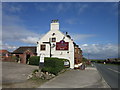
9
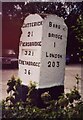
Old Milestone, on the B6265 (was A1), Kirby Hill
N of Boroughbridge. Located on the West side of road, at entrance to car park of Blue Bell Inn. Carved stone post, 18th/19th century. Alternative views see https://www.geograph.org.uk/photo/1433529 & http://www.geograph.org.uk/photo/2145024 & http://www.geograph.org.uk/photo/2145028 & http://www.geograph.org.uk/photo/5936057
Inscription reads: CATTERICK / 21 / PIERSBRIDGE / 32½ / GRETA BRIDGE / 36 // BORO / BRIDGE / 1 / LONDON / 203
Grade II listed by Historic England.
Milestone Society National ID: YN_BBGB01
Image: © Christine Minto
Taken: 21 Dec 2005
0.10 miles
10
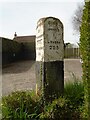
Old milestone
This quadrant shaped milestone at the Blue Bell Inn at Kirby Hill north of Boroughbridge was painted in 2002 by a Milestone Society member. Now the B6265 this was once the A1 and The Great North Road. Piersbridge is now spelt Piercebridge. And the mileage may have been altered at some time in the stones' history as 32½ is set in a recess. The stone may date from the 18C or 19C and is Grade II Listed.
Image: © Chris Minto
Taken: 17 Apr 2022
0.10 miles