
IMAGES TAKEN NEAR TO
Langthorpe, Boroughbridge, YORK, YO51 9BH
Introduction
This page details the photographs taken nearby to YO51 9BH by members of the Geograph project.
The Geograph project started in 2005 with the aim of publishing, organising and preserving representative images for every square kilometre of Great Britain, Ireland and the Isle of Man.

There are currently over 7.5m images from over14,400 individuals and you can help contribute to the project by visiting https://www.geograph.org.uk
Image Map
Images are licensed for reuse under creativecommons.org/licenses/by-sa/2.0
Notes
- Clicking on the map will re-center to the selected point.
- The higher the marker number, the further away the image location is from the centre of the postcode.
Image Listing (182 Images Found)
Images are licensed for reuse under creativecommons.org/licenses/by-sa/2.0
Image
Details
Distance
1
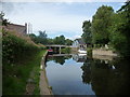
Moorings, River Ure, Boroughbridge
On the south bank of Milby Cut.
Image: © Christine Johnstone
Taken: 9 Aug 2018
0.02 miles

4
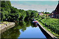
Milby Cut
Canal like waterway that bypasses a weir and other difficult water along the River Ure - allowing navigation to proceed further upstream
Image: © Chris Heaton
Taken: 23 Jun 2015
0.02 miles
5

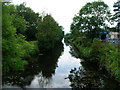
Canal - Boroughbridge
Running parallel to the Ure at this point is Milby cut, a canal built to bypass the weir.
Image: © DS Pugh
Taken: 28 Mar 2007
0.03 miles
6
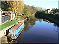
Milby Cut
Part of the Ure navigation, built to bypass the weir at Borough Bridge. This is the longest of the navigational cuts on the river, at just under 1 km. With the Ripon Canal, it gave access to the heart of the important town of Ripon.
Image: © Alan Murray-Rust
Taken: 5 Nov 2009
0.03 miles
7
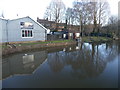
High water in the Milby Cut
The cut and its associated lock were constructed in 1769 to bypass the weir at Boroughbridge. The high water follows a period of heavy rain that caused severe flooding over much of North Yorkshire
Image: © Graham Hogg
Taken: 29 Dec 2015
0.03 miles
9

Boroughbridge Sanitary Station
Part of the recent refurbishment of the Ure navigation and the Ripon Canal. Built in conjunction with the restoration of the Ripon Canal in the 1980s and 90s.
Image: © Alan Murray-Rust
Taken: 5 Nov 2009
0.03 miles
10
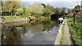
Moorings on the Milby Cut
The photograph was taken a few metres to the east of a roundabout that bridges the Image in Boroughbridge. At the far end of the moorings the path joins a public right of way that leads downstream toward Milby Lock.
See also these photographs by:-
DS Pugh:- Image,
Ian S:- Image and
Graham Hogg:- Image
Image: © Alan Walker
Taken: 10 Apr 2017
0.03 miles