IMAGES TAKEN NEAR TO
Long Lane, YORK, YO42 4PW
Introduction
This page details the photographs taken nearby to Long Lane, YO42 4PW by members of the Geograph project.
The Geograph project started in 2005 with the aim of publishing, organising and preserving representative images for every square kilometre of Great Britain, Ireland and the Isle of Man.

There are currently over 7.5m images from over14,400 individuals and you can help contribute to the project by visiting https://www.geograph.org.uk
Image Map (Loading...)


Getting Data...Please wait
Leaflet Map data © OpenStreetMap
Images are licensed for reuse under creativecommons.org/licenses/by-sa/2.0
Notes
- Clicking on the map will re-center to the selected point.
- The higher the marker number, the further away the image location is from the centre of the postcode.
Image Listing (8 Images Found)
Images are licensed for reuse under creativecommons.org/licenses/by-sa/2.0
Image
Details
Distance
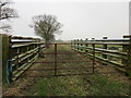
1
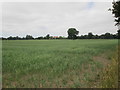
Over crop to Aughton Ruddings Grange
This field edge footpath goes to Long Lane
Image: © Martin Dawes
Taken: 4 Jul 2018
0.12 miles
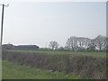
3
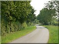
The Road From Laytham To Aughton
The road in the photograph is a continuation of Long Lane but, apparently, no longer known as such
Image: © Roger Gilbertson
Taken: 20 Jul 2006
0.19 miles
4
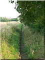
An Erstwhile Watercourse
A long period of dry weather had dried the drain completely
Image: © Roger Gilbertson
Taken: 20 Jul 2006
0.19 miles
7
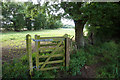
Public right of way towards Common End Plantation
Image: © Ian S
Taken: 29 Jul 2020
0.22 miles
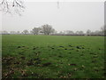
8
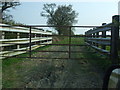
Animal pen
At the entrance to grass fields off Long Lane.
Image: © Jonathan Thacker
Taken: 27 Jan 2017
0.24 miles