IMAGES TAKEN NEAR TO
Dauby Lane, YORK, YO41 5LH
Introduction
This page details the photographs taken nearby to Dauby Lane, YO41 5LH by members of the Geograph project.
The Geograph project started in 2005 with the aim of publishing, organising and preserving representative images for every square kilometre of Great Britain, Ireland and the Isle of Man.

There are currently over 7.5m images from over14,400 individuals and you can help contribute to the project by visiting https://www.geograph.org.uk
Image Map
Images are licensed for reuse under creativecommons.org/licenses/by-sa/2.0
Notes
- Clicking on the map will re-center to the selected point.
- The higher the marker number, the further away the image location is from the centre of the postcode.
Image Listing (10 Images Found)
Images are licensed for reuse under creativecommons.org/licenses/by-sa/2.0
Image
Details
Distance
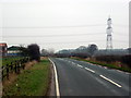
1

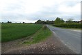
Towards Low Barns Farm
Looking along Dauby Lane towards the A1079.
Image: © DS Pugh
Taken: 22 May 2022
0.02 miles
2
Road near Low Barns Farm
Looking along Dauby Lane.
Image: © DS Pugh
Taken: 17 Apr 2017
0.02 miles
3
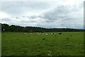
Cattle beside Dauby Lane
Looking across farmland to the west of the road.
Image: © DS Pugh
Taken: 22 May 2022
0.05 miles
4
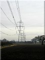
Power Lines
Taken at MR: SE69505068 looking eastwards
Image: © Andy Beecroft
Taken: 18 Jan 2006
0.06 miles
6
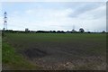
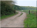
Farmland near Low Barns Farm
Looking across fields towards the powerlines crossing the farmland.
Image: © DS Pugh
Taken: 17 Apr 2017
0.10 miles
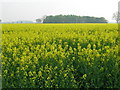
8
Fields beside Dauby Lane
Looking across arable fields to the east of the road.
Image: © DS Pugh
Taken: 22 May 2022
0.12 miles
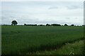
10
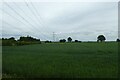
Fields and overhead cables
Looking across arable farmland from Dauby Lane.
Image: © DS Pugh
Taken: 22 May 2022
0.19 miles