
IMAGES TAKEN NEAR TO
Scoreby, YORK, YO41 1NR
Introduction
This page details the photographs taken nearby to Scoreby, YO41 1NR by members of the Geograph project.
The Geograph project started in 2005 with the aim of publishing, organising and preserving representative images for every square kilometre of Great Britain, Ireland and the Isle of Man.

There are currently over 7.5m images from over14,400 individuals and you can help contribute to the project by visiting https://www.geograph.org.uk
Image Map
Images are licensed for reuse under creativecommons.org/licenses/by-sa/2.0
Notes
- Clicking on the map will re-center to the selected point.
- The higher the marker number, the further away the image location is from the centre of the postcode.
Image Listing (52 Images Found)
Images are licensed for reuse under creativecommons.org/licenses/by-sa/2.0
Image
Details
Distance
1
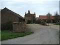
Lime Field Farm
Farm with holiday cottages passed by a bridleway and Cycle Route No 66.
Image: © Chris Heaton
Taken: 9 Apr 2010
0.01 miles
2
Towards Lime Field Farm
A bridleway (and Sustrans route 66) heads to the farm.
Image: © DS Pugh
Taken: 7 Apr 2013
0.02 miles
3
Lime Field Farm
Looking east to Lime Field Farm. This bridleway is part of Sustrans route 66.
Image: © DS Pugh
Taken: 12 Apr 2007
0.02 miles
4
Limefield Farm
Would the name refer to a field with naturally lime soil, or one that needed lime to fertilise it? Either way, the wheat seemed to be growing well. See Image for a closer view of the buildings.
Image: © Stephen Craven
Taken: 7 Jul 2017
0.02 miles
5
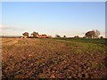
Lime Field Farm
Sustrans route 66 runs through this farm. In the distance beyond, the Wolds can be seen rising up.
Image: © DS Pugh
Taken: 26 Nov 2006
0.02 miles
6
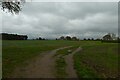
Towards Lime Field Farm
The path forms part of Sustrans National Cycle Route 66 between York and Stamford Bridge.
Image: © DS Pugh
Taken: 14 Nov 2020
0.04 miles
7
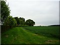
Lime Field Farm
A neat hedgerow at Lime Field Farm viewed from the Dunnington bridleway which forms part of Sustrans route 66.
Image: © DS Pugh
Taken: 25 May 2009
0.04 miles
8
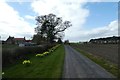
Lime Field Farm
Looking along the daffodil lined road leading to the farm.
Image: © DS Pugh
Taken: 31 Mar 2019
0.04 miles
9
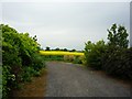
Replacement bridleway
An alternative bridleway avoiding the farmyard at Lime Field Farm was created several years ago.
Image: © DS Pugh
Taken: 25 May 2009
0.05 miles
10

Path west of Lime Field Farm
The path forms part of National Cycle Network route 66.
Image: © DS Pugh
Taken: 28 May 2023
0.05 miles