IMAGES TAKEN NEAR TO
Sand Hutton, YORK, YO41 1LJ
Introduction
This page details the photographs taken nearby to YO41 1LJ by members of the Geograph project.
The Geograph project started in 2005 with the aim of publishing, organising and preserving representative images for every square kilometre of Great Britain, Ireland and the Isle of Man.

There are currently over 7.5m images from over14,400 individuals and you can help contribute to the project by visiting https://www.geograph.org.uk
Image Map (Loading...)


Getting Data...Please wait
Leaflet Map data © OpenStreetMap
Images are licensed for reuse under creativecommons.org/licenses/by-sa/2.0
Notes
- Clicking on the map will re-center to the selected point.
- The higher the marker number, the further away the image location is from the centre of the postcode.
Image Listing (8 Images Found)
Images are licensed for reuse under creativecommons.org/licenses/by-sa/2.0
Image
Details
Distance
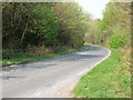
2
Marathon runners on Stamford Bridge Road
The road is closed for the Yorkshire Marathon with this section being between 11 and 12 miles.
Image: © DS Pugh
Taken: 15 Oct 2023
0.17 miles
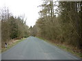
4
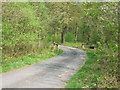
Stamford Bridge Road
Looking although the road through Buttercrambe Moor Wood.
Image: © DS Pugh
Taken: 23 Sep 2023
0.19 miles
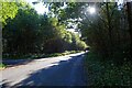
5
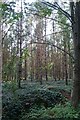
Buttercrambe Moor Wood
Looking through the trees from Stamford Bridge Road.
Image: © DS Pugh
Taken: 23 Sep 2023
0.20 miles
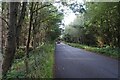
6
Buttercrambe Moor Wood, north of Stamford Bridge
Image: © Ian S
Taken: 26 Mar 2011
0.22 miles
7
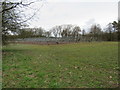
Near Buttercrambe Moor Wood
This could be for some sort of canopy?
Image: © T Eyre
Taken: 18 Mar 2017
0.24 miles
8
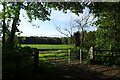
Gate beside Stamford Bridge Road
Looking into a field in Buttercrambe Moor Wood to the west of the road.
Image: © DS Pugh
Taken: 23 Sep 2023
0.24 miles