
IMAGES TAKEN NEAR TO
Buttercrambe Road, YORK, YO41 1AW
Introduction
This page details the photographs taken nearby to Buttercrambe Road, YO41 1AW by members of the Geograph project.
The Geograph project started in 2005 with the aim of publishing, organising and preserving representative images for every square kilometre of Great Britain, Ireland and the Isle of Man.

There are currently over 7.5m images from over14,400 individuals and you can help contribute to the project by visiting https://www.geograph.org.uk
Image Map
Images are licensed for reuse under creativecommons.org/licenses/by-sa/2.0
Notes
- Clicking on the map will re-center to the selected point.
- The higher the marker number, the further away the image location is from the centre of the postcode.
Image Listing (10 Images Found)
Images are licensed for reuse under creativecommons.org/licenses/by-sa/2.0
Image
Details
Distance
1
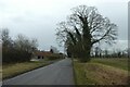
Road near Primrose Hill
Looking along the road towards Stamford Bridge.
Image: © DS Pugh
Taken: 30 Dec 2021
0.03 miles
2
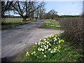
Buttercrambe Road
The road just north of Stamford Bridge, outside Primrose Hill Farm.
Image: © Chris Heaton
Taken: 9 Apr 2010
0.08 miles
3
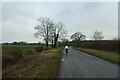
Buttercrambe Road
Looking along the road from Stamford Bridge towards Buttercrambe.
Image: © DS Pugh
Taken: 30 Dec 2021
0.09 miles
4
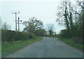
Buttercrambe Road near Primrose Hill Farm
Image: © Colin Pyle
Taken: 26 Apr 2021
0.12 miles
5
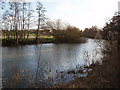
River Derwent
River Derwent looking towards Stamford Bridge
Image: © Kath Bonson
Taken: 13 Feb 2005
0.20 miles
6

Field beside the River Derwent
Rough grazing in fields beside the River Derwent upstream of Stamford Bridge.
Image: © DS Pugh
Taken: 4 May 2025
0.21 miles
7
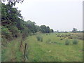
Riverside path near Stamford Bridge
The Derwent is hidden by dense undergrowth on the left
Image: © David Brown
Taken: 19 Jul 2019
0.24 miles
8
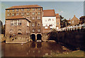
The Corn Mill Stamford Bridge
The former Corn Mill as a restaurant
Image: © Kath Bonson
Taken: Unknown
0.24 miles
9

Old canal cut, Stamford Bridge
Once used as a canal cut with a lock to by-pass the local mill and weir on the Derwent. Part of the scheme to link Malton with the Ouse/Humber system, but long since disused.
Image: © Gordon Hatton
Taken: 9 Aug 2021
0.24 miles
10
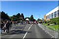
Marathon in Stamford Bridge
The road is closed for the Yorkshire Marathon with this section being between 13 and 14 miles. The marathon heads into the outskirts of Stamford Bridge and performs a U-turn.
Image: © DS Pugh
Taken: 15 Oct 2023
0.25 miles