
IMAGES TAKEN NEAR TO
New Lane, YORK, YO32 9NW
Introduction
This page details the photographs taken nearby to New Lane, YO32 9NW by members of the Geograph project.
The Geograph project started in 2005 with the aim of publishing, organising and preserving representative images for every square kilometre of Great Britain, Ireland and the Isle of Man.

There are currently over 7.5m images from over14,400 individuals and you can help contribute to the project by visiting https://www.geograph.org.uk
Image Map
Images are licensed for reuse under creativecommons.org/licenses/by-sa/2.0
Notes
- Clicking on the map will re-center to the selected point.
- The higher the marker number, the further away the image location is from the centre of the postcode.
Image Listing (8 Images Found)
Images are licensed for reuse under creativecommons.org/licenses/by-sa/2.0
Image
Details
Distance
1
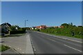
New Lane at Kendrew Close
Looking along New Lane in Huntington.
Image: © DS Pugh
Taken: 31 May 2021
0.10 miles
2
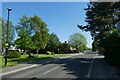
New Lane near Portakabin
Looking along New Lane in Huntington.
Image: © DS Pugh
Taken: 31 May 2021
0.15 miles
3
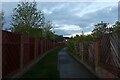
Path from Stratford Way
Leading to New Lane.
Image: © DS Pugh
Taken: 22 May 2021
0.18 miles
4
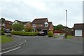
Path to New Lane
Looking towards a cycle path linking Stratford Way to New Lane.
Image: © DS Pugh
Taken: 23 Jun 2019
0.19 miles
5
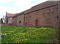
The Manor House
This motley collection of what appears to be old outbuildings is marked on OS maps as 'The Manor House' - so who am I to argue?
Image: © Weston Beggard
Taken: 29 Apr 2006
0.19 miles
6
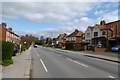
Housing on Huntington Road
Looking away from the city along Huntington Road.
Image: © DS Pugh
Taken: 13 Apr 2014
0.20 miles
7
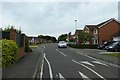
Stratford Way
Looking along a street in the Huntington area.
Image: © DS Pugh
Taken: 23 Jun 2019
0.22 miles
8
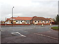
Huntington Working Men's Social Club
Situated opposite the Northern end of New Lane, this is a working men's (and presumably working women's) social club with a bar and entertainment area. Membership is required.
Image: © Martin Roberts
Taken: 9 Dec 2021
0.23 miles