IMAGES TAKEN NEAR TO
Old Orchard, YORK, YO32 3DS
Introduction
This page details the photographs taken nearby to Old Orchard, YO32 3DS by members of the Geograph project.
The Geograph project started in 2005 with the aim of publishing, organising and preserving representative images for every square kilometre of Great Britain, Ireland and the Isle of Man.

There are currently over 7.5m images from over14,400 individuals and you can help contribute to the project by visiting https://www.geograph.org.uk
Image Map
Images are licensed for reuse under creativecommons.org/licenses/by-sa/2.0
Notes
- Clicking on the map will re-center to the selected point.
- The higher the marker number, the further away the image location is from the centre of the postcode.
Image Listing (38 Images Found)
Images are licensed for reuse under creativecommons.org/licenses/by-sa/2.0
Image
Details
Distance
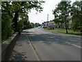
2
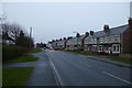
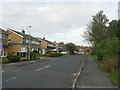
Houses on York Road
Looking along York Road in Haxby in the direction of York.
Image: © DS Pugh
Taken: 5 Jan 2014
0.06 miles
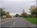
3
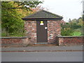
Electricity Substation - York Road
Image: © Betty Longbottom
Taken: 29 Oct 2011
0.07 miles
7
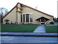
St Margaret Clitherow RC Church, Haxby
Built in the 1980s within a 1970s housing development
Image: © Gary Knighton
Taken: 27 Jan 2007
0.14 miles
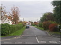
9
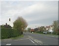
York Road - viewed from Holly Tree Lane
Image: © Betty Longbottom
Taken: 29 Oct 2011
0.15 miles