
IMAGES TAKEN NEAR TO
Wigginton Road, YORK, YO31 8YU
Introduction
This page details the photographs taken nearby to Wigginton Road, YO31 8YU by members of the Geograph project.
The Geograph project started in 2005 with the aim of publishing, organising and preserving representative images for every square kilometre of Great Britain, Ireland and the Isle of Man.

There are currently over 7.5m images from over14,400 individuals and you can help contribute to the project by visiting https://www.geograph.org.uk
Image Map
Images are licensed for reuse under creativecommons.org/licenses/by-sa/2.0
Notes
- Clicking on the map will re-center to the selected point.
- The higher the marker number, the further away the image location is from the centre of the postcode.
Image Listing (97 Images Found)
Images are licensed for reuse under creativecommons.org/licenses/by-sa/2.0
Image
Details
Distance
1
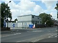
Temporary buildings, York Hospital
At the entrance off Wigginton Road.
Image: © Christine Johnstone
Taken: 6 Aug 2022
0.05 miles
3
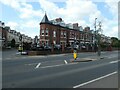
Tower House, Wigginton Road, York
House built in 1895 by Rowntrees, for the factory doctor. Converted to a guest house in the 1980s.
Image: © Christine Johnstone
Taken: 6 Aug 2022
0.06 miles
4
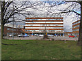
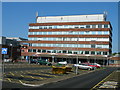
York Hospital
The hospital, on Wiggington Road.
Image: © David Dixon
Taken: 4 Apr 2010
0.06 miles
6
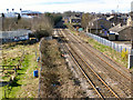
Railway to York
Looking south from Chrichton Avenue, towards York.
Image: © David Dixon
Taken: 4 Apr 2010
0.11 miles
8

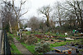
Housing construction on Wigginton Road allotments
Viewed from Crichton Avenue bridge over the York to Scarborough railway lines.
Image: © DS Pugh
Taken: 15 Jul 2025
0.12 miles
9

Sustrans Route 66 - The York end
This Sustrans national cycle route runs from York out to Beverley. This stretch is on an old railway trackbed which used to form a branch running from a junction with the York - Scarborough line, down through Murton & Wheldrake, and then joining back to other branches just to the east of Selby.
As a cycle route, the railway is used between the Nestle chocolate factory and Osbaldwick, beyond Osbaldwick quiet roads take you as far as Market Weighton before joining the old York to Beverley railway.
This is the start of route 66, between York hospital and the Nestle factory. Routes from here run towards New Earswick, and to the city via the hospital. The bridge in front carries the B1363. The city is to the right.
Image: © DS Pugh
Taken: 18 May 2006
0.13 miles
10
Waste land seen from Foss Islands Cycle Path, York
Image: © habiloid
Taken: 1 Mar 2024
0.13 miles