
IMAGES TAKEN NEAR TO
Claremont Terrace, YORK, YO31 7EJ
Introduction
This page details the photographs taken nearby to Claremont Terrace, YO31 7EJ by members of the Geograph project.
The Geograph project started in 2005 with the aim of publishing, organising and preserving representative images for every square kilometre of Great Britain, Ireland and the Isle of Man.

There are currently over 7.5m images from over14,400 individuals and you can help contribute to the project by visiting https://www.geograph.org.uk
Image Map
Images are licensed for reuse under creativecommons.org/licenses/by-sa/2.0
Notes
- Clicking on the map will re-center to the selected point.
- The higher the marker number, the further away the image location is from the centre of the postcode.
Image Listing (1147 Images Found)
Images are licensed for reuse under creativecommons.org/licenses/by-sa/2.0
Image
Details
Distance
1

Claremont Terrace seen from Gillygate (A1036), York
Image: © habiloid
Taken: 31 Aug 2022
0.01 miles


4

York Minster
The Minster from Duncombe Place
Image: © Kevin Rushton
Taken: 7 Aug 2005
0.03 miles


7

De Grey Court building, York St John University
A new university building at York St John University received an award from York city centre has scooped a top architectural design award the Royal Institute of British Architects (RIBA) Awards for architectural excellence. The building cost £15.5 million to build and was designed by Charles Thomson, of Rivington Street Studio Architects in London.
Students began using De Grey Court for lectures and seminars in January 2009.
Image: © Lisa Jarvis
Taken: 18 Oct 2009
0.04 miles
9

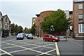
Salvation Army Citadel, Gillygate
Built in 1882-3 in a typical Salvation Army 'Citadel' style, declaring war on sin and the demon drink. The army have been doing good work from this site for over 120 years.
Update 2022. The SA Citadel has now been sold and services are now held at Burton Green Primary School, which I assume is a temporary address.
Image: © Gordon Hatton
Taken: 6 Jan 2009
0.04 miles
10

Lord Mayor's Walk
Looking towards the junction with Gillygate.
Image: © DS Pugh
Taken: 3 Oct 2021
0.05 miles