
IMAGES TAKEN NEAR TO
Sykes Close, St. Olaves Road, YORK, YO30 6HZ
Introduction
This page details the photographs taken nearby to Sykes Close, St. Olaves Road, YO30 6HZ by members of the Geograph project.
The Geograph project started in 2005 with the aim of publishing, organising and preserving representative images for every square kilometre of Great Britain, Ireland and the Isle of Man.

There are currently over 7.5m images from over14,400 individuals and you can help contribute to the project by visiting https://www.geograph.org.uk
Image Map
Images are licensed for reuse under creativecommons.org/licenses/by-sa/2.0
Notes
- Clicking on the map will re-center to the selected point.
- The higher the marker number, the further away the image location is from the centre of the postcode.
Image Listing (163 Images Found)
Images are licensed for reuse under creativecommons.org/licenses/by-sa/2.0
Image
Details
Distance
1
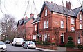
Holme Lea Manor
Described as a 'boutique' bed and breakfast establishment, Holme Lea Manor is one of the large Victorian [circa 1880] properties on St Peter's Grove.
Image: © Gordon Hatton
Taken: 2 Mar 2012
0.03 miles
2
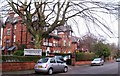
Marmadukes Hotel
Marmadukes is on St Peter's Grove, a cul de sac lined with large red brick Victorian villas, this one having been converted into a hotel.
Image: © Gordon Hatton
Taken: 2 Mar 2012
0.05 miles
4
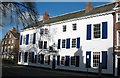
The White House, Clifton
Thomas Bowes, alderman of the city, had this house erected in 1770. Much altered over the years, so it lacks the usual symmetry of the Georgian house.
Image: © Gordon Hatton
Taken: 30 Jan 2008
0.06 miles
5
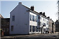
The White House, on the junction of St Olaves Road
Image: © Michael Jagger
Taken: 20 Feb 2010
0.06 miles

7
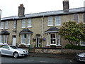
Aaron Guest House, Bootham Crescent
One of many in this part of York.
Image: © John H Darch
Taken: 20 Sep 2012
0.06 miles
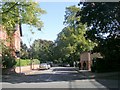
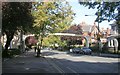
10
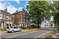
14-16 Clifton
14-16 Clifton is the building in the centre of the photo. It was built around 1800 and is grade II listed - see www.historicengland.org.uk/listing/the-list/list-entry/1259251.
Image: © Ian Capper
Taken: 20 Jul 2017
0.08 miles