IMAGES TAKEN NEAR TO
Flavian Grove, YORK, YO30 5SQ
Introduction
This page details the photographs taken nearby to Flavian Grove, YO30 5SQ by members of the Geograph project.
The Geograph project started in 2005 with the aim of publishing, organising and preserving representative images for every square kilometre of Great Britain, Ireland and the Isle of Man.

There are currently over 7.5m images from over14,400 individuals and you can help contribute to the project by visiting https://www.geograph.org.uk
Image Map
Images are licensed for reuse under creativecommons.org/licenses/by-sa/2.0
Notes
- Clicking on the map will re-center to the selected point.
- The higher the marker number, the further away the image location is from the centre of the postcode.
Image Listing (5 Images Found)
Images are licensed for reuse under creativecommons.org/licenses/by-sa/2.0
Image
Details
Distance
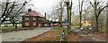

4
Clifton
From sustrans cycle route 65 following the river.
Image: © DS Pugh
Taken: 14 Jan 2006
0.23 miles
5
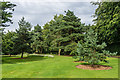
Homestead Park
14 acre park opened in 1904 by Benjamin Seebohm Rowntree, son of Joseph Rowntree, and owned and maintained by the Joseph Rowntree Foundation. Adjacent Homestead House, home of Benjamin from 1904 to 1936, is now the headquarters of the foundation.
Image: © Ian Capper
Taken: 20 Jul 2017
0.24 miles