
IMAGES TAKEN NEAR TO
Cheshire Close, YORK, YO30 5NE
Introduction
This page details the photographs taken nearby to Cheshire Close, YO30 5NE by members of the Geograph project.
The Geograph project started in 2005 with the aim of publishing, organising and preserving representative images for every square kilometre of Great Britain, Ireland and the Isle of Man.

There are currently over 7.5m images from over14,400 individuals and you can help contribute to the project by visiting https://www.geograph.org.uk
Image Map
Images are licensed for reuse under creativecommons.org/licenses/by-sa/2.0
Notes
- Clicking on the map will re-center to the selected point.
- The higher the marker number, the further away the image location is from the centre of the postcode.
Image Listing (16 Images Found)
Images are licensed for reuse under creativecommons.org/licenses/by-sa/2.0
Image
Details
Distance
1
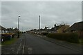
Manor Park Road
Looking along Manor Park Road near Elma Grove.
Image: © DS Pugh
Taken: 19 Feb 2021
0.10 miles
2
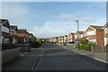
St. Mark's Grove
Looking along a street in the Rawcliffe area of York.
Image: © DS Pugh
Taken: 22 Sep 2022
0.12 miles
3
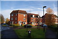
New housing on Armstrong Way
One of many new housing developments off Manor Lane in Rawcliffe, right on the edge of York.
Image: © Bill Boaden
Taken: 17 Nov 2012
0.12 miles
4
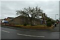
St. Mark's Church
Looking towards the Church on St. Mark's Grove.
Image: © DS Pugh
Taken: 19 Feb 2021
0.15 miles
5
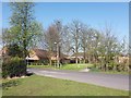
Manor Lane
Looking from Village Street onto Manor Lane.
Image: © DS Pugh
Taken: 20 Apr 2016
0.17 miles
6
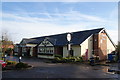
The Lysander Arms, Rawcliffe
An entry in the Good Beer Guide, which at first I found surprising as it is a brand new pub on a brand new estate. However it served three fully satisfactory beers and one could watch football in relaxing circumstances.
Image: © Bill Boaden
Taken: 17 Nov 2012
0.17 miles
7
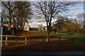
Surviving green space in Rawcliffe
Much of this part of Rawcliffe has been swallowed up in new housing development.
Image: © Bill Boaden
Taken: 17 Nov 2012
0.19 miles
8

Cycle path near Holyrood Drive
The path connects from Manor Lane to Holyrood Drive.
Image: © DS Pugh
Taken: 15 Jul 2025
0.20 miles
9
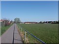
Path along playing fields
A foot/cycle path alongside sports fields in Rawcliffe.
Image: © DS Pugh
Taken: 20 Apr 2016
0.20 miles
10
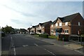
Path crossing Boothwood Road
A cycle path crossing this residential street in Clifton Moor.
Image: © DS Pugh
Taken: 22 Sep 2022
0.21 miles