IMAGES TAKEN NEAR TO
Atterwith Lane, YORK, YO26 7PZ
Introduction
This page details the photographs taken nearby to Atterwith Lane, YO26 7PZ by members of the Geograph project.
The Geograph project started in 2005 with the aim of publishing, organising and preserving representative images for every square kilometre of Great Britain, Ireland and the Isle of Man.

There are currently over 7.5m images from over14,400 individuals and you can help contribute to the project by visiting https://www.geograph.org.uk
Image Map
Images are licensed for reuse under creativecommons.org/licenses/by-sa/2.0
Notes
- Clicking on the map will re-center to the selected point.
- The higher the marker number, the further away the image location is from the centre of the postcode.
Image Listing (13 Images Found)
Images are licensed for reuse under creativecommons.org/licenses/by-sa/2.0
Image
Details
Distance
1
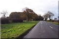
Approaching Fox Covert
On Atterwith Lane, near Long Marston
Image: © Jonathan Billinger
Taken: 6 Dec 2006
0.04 miles
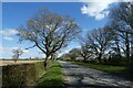
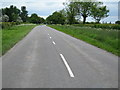
2
Across Atterwith Lane
The road runs between Long Marston and Hessay.
Image: © DS Pugh
Taken: 5 Apr 2021
0.04 miles
3
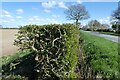
Hedgerow along Atterwith Lane
Looking along a hawthorn hedge.
Image: © DS Pugh
Taken: 5 Apr 2021
0.05 miles
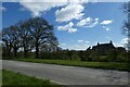
5
Fields beside Atterwith Lane
Looking across farmland near Oak Tree Farm.
Image: © DS Pugh
Taken: 5 Apr 2021
0.09 miles
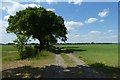
7
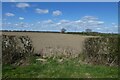
Field beside Atterwith Lane
Looking into a field on the road between Long Marston and Hessay.
Image: © DS Pugh
Taken: 5 Apr 2021
0.13 miles
8
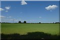
Farmland beside Atterwith Lane
Looking across part of Marston Moor.
Image: © DS Pugh
Taken: 31 May 2020
0.15 miles
9
Track off Atterwith Lane
Looking along a track on Marston Moor.
Image: © DS Pugh
Taken: 31 May 2020
0.17 miles
10
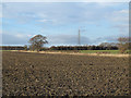
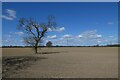
Ploughed field with lone tree
The field which lies to the east of the civil war battlefield of Marston Moor, has certainly been ploughed and perhaps even sown, though at the time the image was recorded, no crop was showing. The single tree is on a field boundary line which is partly fenced and partly hedged, so it could be a hedge tree gone rogue.
Image: © Trevor Littlewood
Taken: 23 Jan 2014
0.18 miles