
IMAGES TAKEN NEAR TO
Bismarck Street, YORK, YO26 4XY
Introduction
This page details the photographs taken nearby to Bismarck Street, YO26 4XY by members of the Geograph project.
The Geograph project started in 2005 with the aim of publishing, organising and preserving representative images for every square kilometre of Great Britain, Ireland and the Isle of Man.

There are currently over 7.5m images from over14,400 individuals and you can help contribute to the project by visiting https://www.geograph.org.uk
Image Map
Images are licensed for reuse under creativecommons.org/licenses/by-sa/2.0
Notes
- Clicking on the map will re-center to the selected point.
- The higher the marker number, the further away the image location is from the centre of the postcode.
Image Listing (175 Images Found)
Images are licensed for reuse under creativecommons.org/licenses/by-sa/2.0
Image
Details
Distance
1
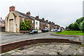
Garnet Terrace
Late Victorian terraced housing built for railway workers.
Image: © Ian Capper
Taken: 19 Jul 2017
0.02 miles
2

Bismarck Street
Late Victorian terraced housing built for railway workers.
Image: © Ian Capper
Taken: 19 Jul 2017
0.04 miles
3
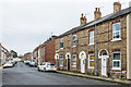
Upper Hanover Street
Late Victorian terraced housing built for railway workers.
Image: © Ian Capper
Taken: 19 Jul 2017
0.06 miles
4
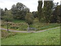
A stream in a park
A small stream in a designated play area.
The invasive Himalayan Balsam is rapidly taking over the streamside.
Image: © Anthony Vosper
Taken: 14 Sep 2023
0.07 miles
5

Construction road through Millennium Green
A temporary access road is in place to allow construction of a new bridge over the East Coast mainline to connect Water End to the York Central site.
Image: © DS Pugh
Taken: 5 Oct 2025
0.07 miles
6
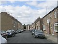
Hanover Street West - Livingstone Street
Image: © Betty Longbottom
Taken: 25 Sep 2010
0.07 miles
7
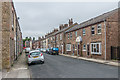
Hanover Street West
Late Victorian terraced housing built for railway workers.
Image: © Ian Capper
Taken: 19 Jul 2017
0.07 miles
8

Clifton Short Reach
This is part of the flood defences for the River Ouse. Flood gates shown in another photo are opened and this low flood meadow takes up the excess water.
Image: © Stuart and Fiona Jackson
Taken: 30 Jun 2005
0.07 miles

10

Leeman Road District War Memorial
This war memorial was originally erected on Balfour Street in 1920 but was moved here to Salisbury Road in 1954. It commemorates 72 local men who lost their lives on military service during the First World War as well as three women (whose names appear in the centre of the panel) killed in an accidental explosion at a shell filling factory.
Image: © Stephen McKay
Taken: 6 Oct 2023
0.08 miles