IMAGES TAKEN NEAR TO
Ash Street, YORK, YO26 4UR
Introduction
This page details the photographs taken nearby to Ash Street, YO26 4UR by members of the Geograph project.
The Geograph project started in 2005 with the aim of publishing, organising and preserving representative images for every square kilometre of Great Britain, Ireland and the Isle of Man.

There are currently over 7.5m images from over14,400 individuals and you can help contribute to the project by visiting https://www.geograph.org.uk
Image Map
Images are licensed for reuse under creativecommons.org/licenses/by-sa/2.0
Notes
- Clicking on the map will re-center to the selected point.
- The higher the marker number, the further away the image location is from the centre of the postcode.
Image Listing (122 Images Found)
Images are licensed for reuse under creativecommons.org/licenses/by-sa/2.0
Image
Details
Distance
1
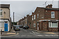
Ash Street
Victorian terraced housing off Poppleton Road.
Image: © Ian Capper
Taken: 19 Jul 2017
0.02 miles
2

Poppleton Road
Short terrace dating from the 19th Century between Oak Street (on the left) and Ash Street (on the right). 1 Ash Street, on the corner, houses the offices of York Conservative Association.
Image: © Ian Capper
Taken: 19 Jul 2017
0.03 miles
3
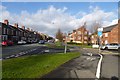
Renshaw Gardens
Looking along Poppleton Road with Renshaw Gardens to the right.
Image: © DS Pugh
Taken: 2 Feb 2014
0.06 miles
4
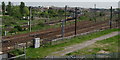
East Coast Main Line
This is the last bend on the line, out of York, for the next 20 miles. On this next dead straight section water troughs allowed steam locomotives to pick up water at speed.
Image: © Ken Crosby
Taken: 11 May 2006
0.07 miles
5

Chatsworth Terrace
Road of early 20th Century terraced housing off Poppleton Road.
Image: © Ian Capper
Taken: 19 Jul 2017
0.08 miles

7
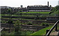
Poppleton Road School & East Coast Main Line
Image: © Ken Crosby
Taken: 11 May 2006
0.09 miles
8
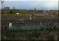
Siddings Gardens and railway
Looking down onto Siddings Gardens play area and the railway lines near Severus Junction. Information on the play area can be found here: https://www.york.gov.uk/directory-record/647/siddings-gardens-play-area
Image: © DS Pugh
Taken: 21 Nov 2021
0.10 miles
9

Looking down the lines
View of the south-going tracks towards York Station.
Image: © Ian Paterson
Taken: 24 Dec 2018
0.11 miles