
IMAGES TAKEN NEAR TO
Grantham Drive, YORK, YO26 4UA
Introduction
This page details the photographs taken nearby to Grantham Drive, YO26 4UA by members of the Geograph project.
The Geograph project started in 2005 with the aim of publishing, organising and preserving representative images for every square kilometre of Great Britain, Ireland and the Isle of Man.

There are currently over 7.5m images from over14,400 individuals and you can help contribute to the project by visiting https://www.geograph.org.uk
Image Map
Images are licensed for reuse under creativecommons.org/licenses/by-sa/2.0
Notes
- Clicking on the map will re-center to the selected point.
- The higher the marker number, the further away the image location is from the centre of the postcode.
Image Listing (82 Images Found)
Images are licensed for reuse under creativecommons.org/licenses/by-sa/2.0
Image
Details
Distance
1
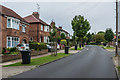
Grantham Drive
1930s housing in a road connecting Poppleton Road and Acomb Road.
Image: © Ian Capper
Taken: 19 Jul 2017
0.01 miles

3
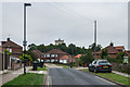
Howe Hill Close
1950s housing off Grantham Drive. In the background is Severus Water Tower, built in 1914 in reinforced concrete by the Trussed Concrete Steel Company - at the time of building its 300,000 gallon capacity was the largest in the country. It was taken out of service in 2007. Its name is a reference to the Roman emperor Septimus Severus, who died in York in 211.
Image: © Ian Capper
Taken: 19 Jul 2017
0.07 miles
4
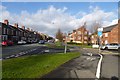
Renshaw Gardens
Looking along Poppleton Road with Renshaw Gardens to the right.
Image: © DS Pugh
Taken: 2 Feb 2014
0.08 miles
5

Class 20 loco at York
The location of the photo (previously submitted via the Speculative Uploads area without attracting any comment) has been identified with reasonable certainty from looking at improved online historic mapping. The photographer locations is alongside Poppleton Road; the building in the background would be the former carriage shed; it has been replaced since the 1980s by housing on Penshaw Gardens. The location of the class 20 diesel loco in the foreground is roughly where the Pride of York Arch now stands Image Ben Brooksbank's 1960 shot Image was probably taken from nearly the same spot (a staff car park, I think). Photo scanned from a colour slide.
Image: © Stephen Craven
Taken: 10 Jul 1983
0.10 miles
6

Pride of York
A rusting arch inscribed 'Pride of York' and a water tower beyond.
Image: © DS Pugh
Taken: 2 Feb 2014
0.10 miles
7

Holgate Park
Looking into Holgate Park from Renshaw Gardens.
Image: © DS Pugh
Taken: 21 Nov 2021
0.11 miles
8
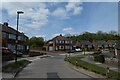
Howe Hill Close
Looking along Howe Hill Close mainly consisting of semi-detached houses.
Image: © DS Pugh
Taken: 25 Apr 2021
0.12 miles
9
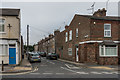
Ash Street
Victorian terraced housing off Poppleton Road.
Image: © Ian Capper
Taken: 19 Jul 2017
0.13 miles
10

Poppleton Road
Short terrace dating from the 19th Century between Oak Street (on the left) and Ash Street (on the right). 1 Ash Street, on the corner, houses the offices of York Conservative Association.
Image: © Ian Capper
Taken: 19 Jul 2017
0.13 miles